That’s what lonely wanderers are called in Britain, apparently, and maybe elsewhere; but in New Zealand tramp is usually a verb. It means: to struggle, with a sort of grim joy, over luminous lumps of the back of beyond.
With Australians, Kiwis call tramps – as in the noun – swagmen: after their bedroll, or swag.
If we call them anything at all, that is.
These derelict, romantic figures used to roam the back roads of New Zealand, especially during the great depression. They would knock on doors and ask for food, and sometimes work.
One “swaggie” used to come to my parent’s farm, a hilly outpost on a gravel road in southern Hawke’s Bay, before I was born. He would take whatever he was given, and eat enormously.
He did a perpetual circuit, hundreds of kilometres long; that was his life.
There was a famous one in Wairarapa called Russian Jack. His real name was Barrett Crumen, according to Te Ara; and he wasn’t Russian but Latvian. There’s a statue of him in Masterton now, and someone named a wine named after him.
The figure of the swagman was especially redolent for me because Dad, an Aussie, would read to us from a lovely, darkly illustrated version of Banjo Paterson’s Waltzing Matilda. It’s an 1897 ballad about a swaggie who drowns himself, after the law comes down hard on him for stealing a sheep to fill his belly.
Sometimes Dad would sing it softly to himself while he shore his own sheep. The sheep seemed to like listening, lying back in his deft, gentle grip, and gazing into space. I’d stand by sweeping up the dags, and think about that poor old swaggie. Why did he have to die? And why did his refusal to be locked up seem so pure?
Another question is why this lament for a lonely death on the margins of polite society has become a de facto Australian anthem; but pithy as it is, I’ll not go into it just now. Except to say that when I was six or so, that violent, sweet old song sure marked the hell out of me.
Oh! There once was a swagman, camped in the Billabong Under the shade of a Coolibah tree; […]
And his ghost may be heard as it sings in the Billabong Who’ll come a-Waltzing Matilda with me?
In this way, among others, I gained a thirst for the tramping life (AKA Waltzing Matilda). Maybe by way of awkward solidarity with all swaggies, drowned or just plain left out: I’ll come a-waltzing with you, Russian Jack.
Despite this blog’s title, I don’t plan to write on here only about tramping. Moonlit or otherwise.
I’m not sure exactly what the title means, if anything. I did once have a wonderful night tramp under an enormous, glowing moon, which flood-lit the Cornish clifftops.
And I do tend to wake late on a tramp, and then dawdle along looking at clouds, talking to the flora and taking many photos; which often means I finish the day’s walk by moon- or torch-light.
But those are other stories, which may be posted another time.
I might write about all sorts of things, but for my first series of posts I’ll write about starting New Zealand’s longest tramp last year: The Te Araroa trail.
That’s mainly because my friend Graham asked me to write about it, to share with our cricket team, the Bottom Paddock Cricket Club. “They’d enjoy it,” he reckoned.
They’re a loveable and quixotic bunch, so he may be right.
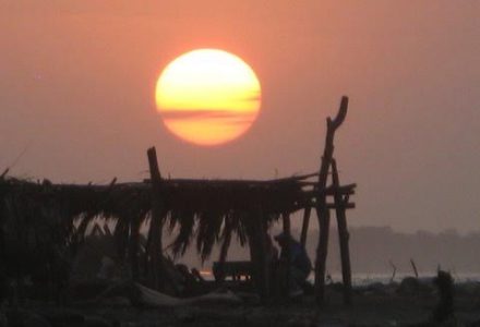
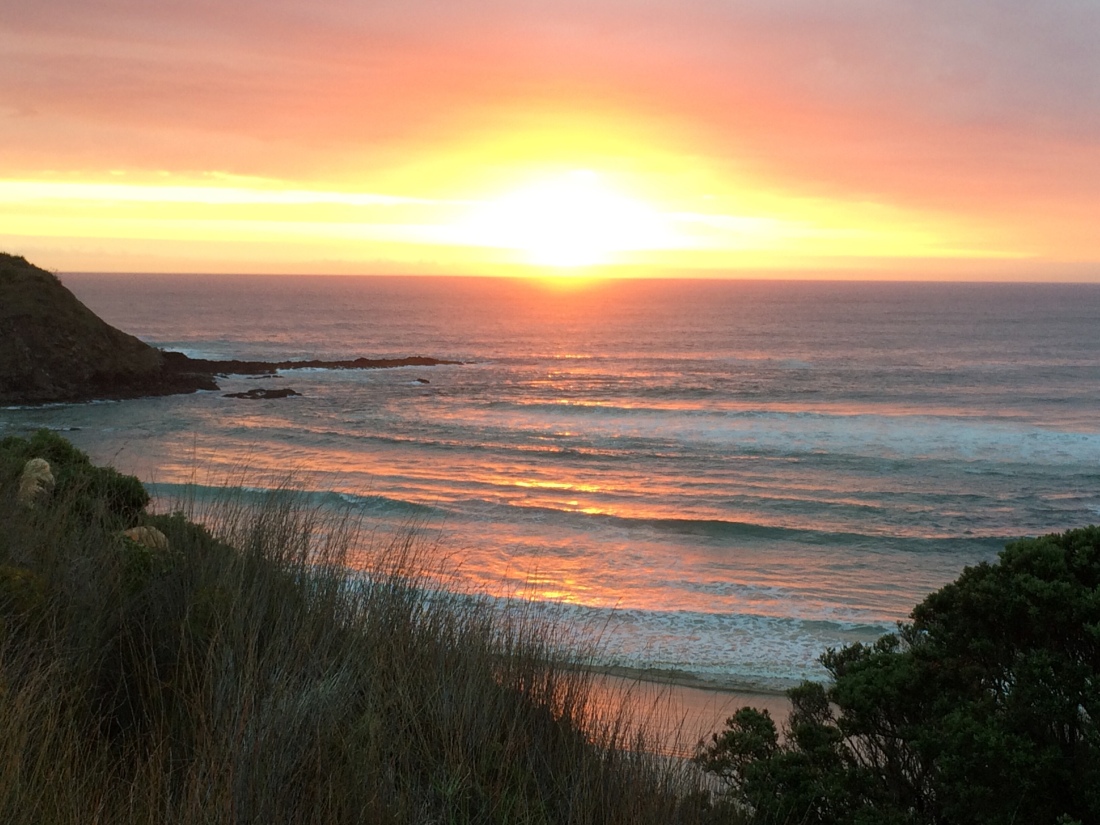
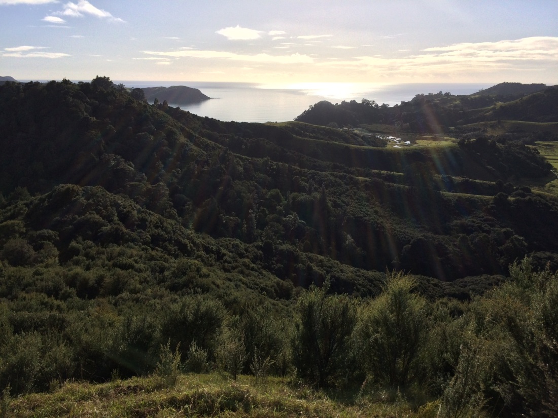
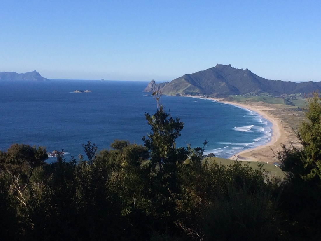
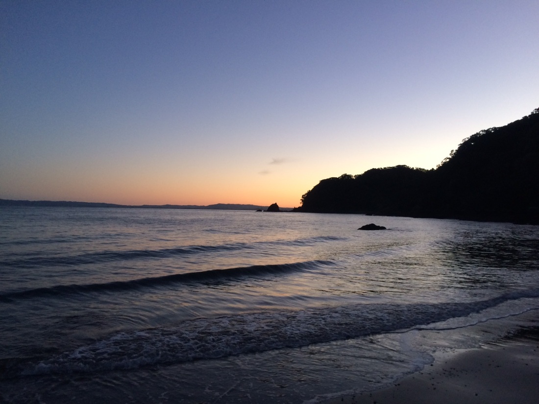
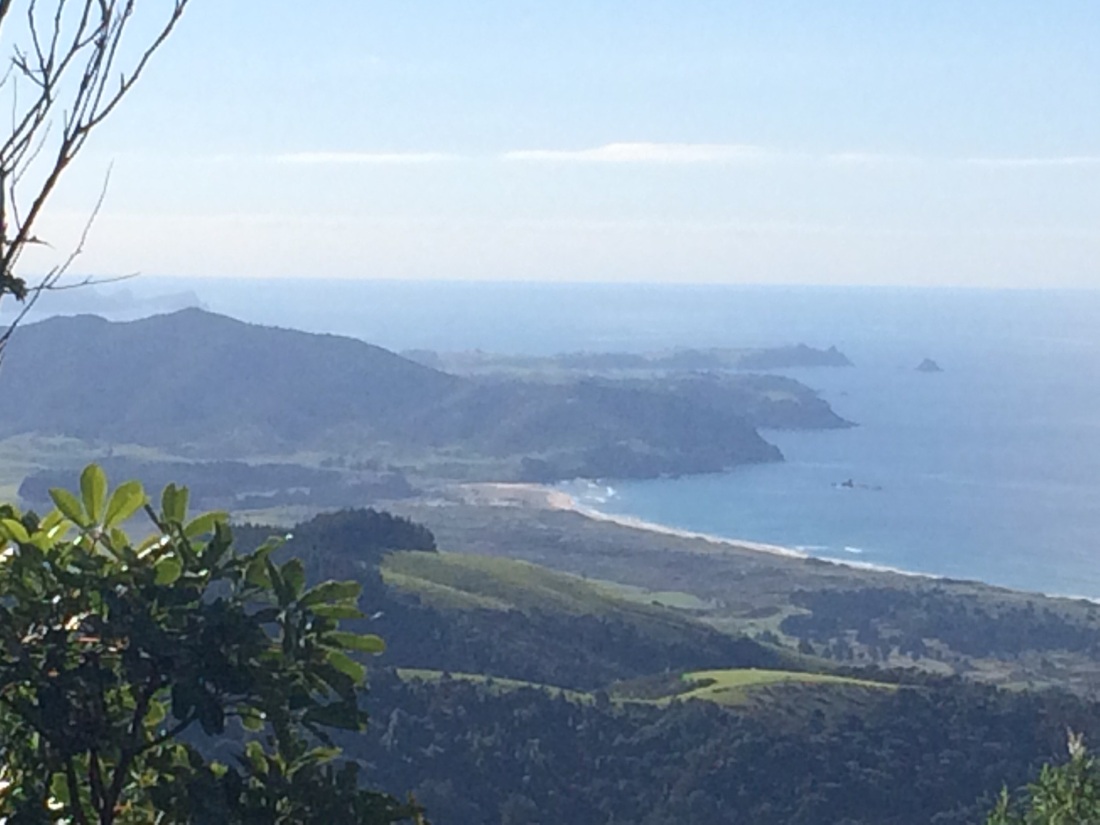
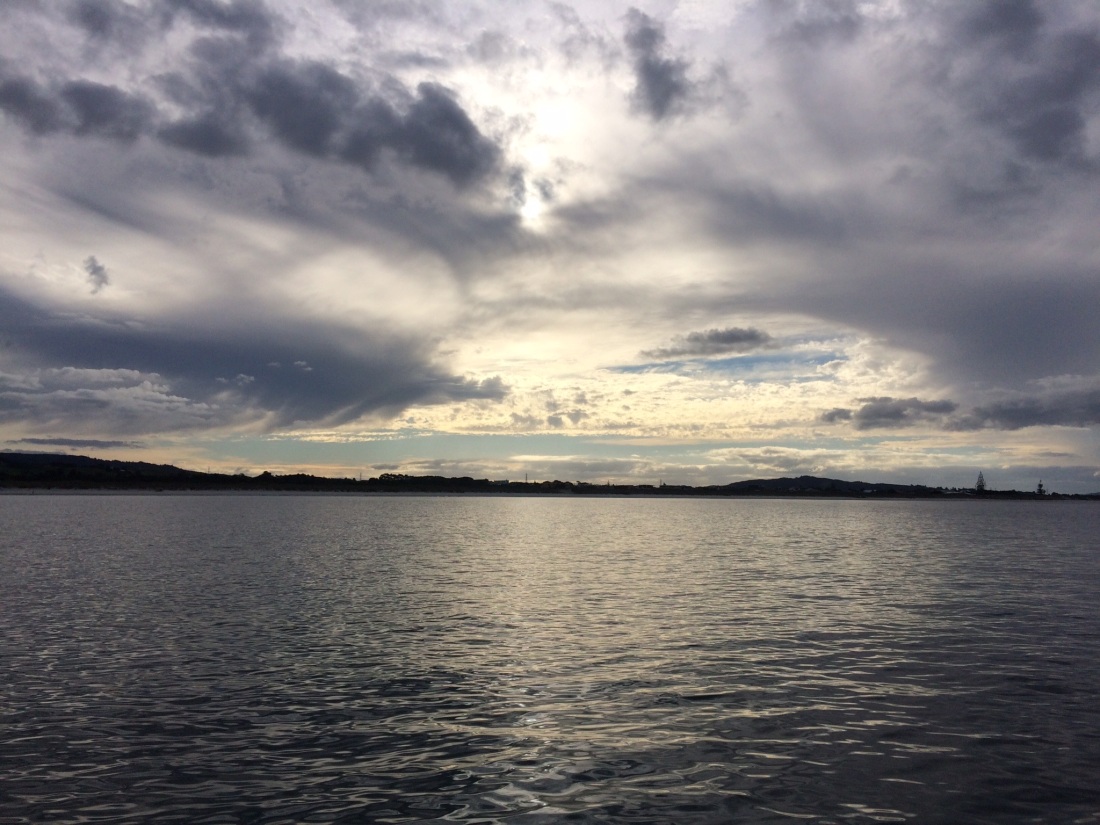
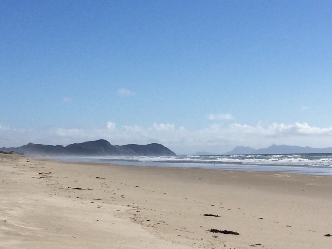
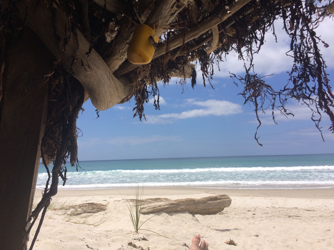
To get the first ball bowled, here’s a shot I took by sunset-light at the end of the first leg, which is 100 kilometres over four days, straight down the country’s longest beach to a little town called Ahipara. When I got there I had been walking for 14 hours and was in a dreamy haze of leaky blisters, leg-aches and extreme exposure to nature. In that state, what I thought was this:
With my more-than-usually-delirious Spanish, Ahipara could mean something like: “stop, there.” And I’m definitely going to do that, since, right now, I want never to walk again.
I also thought:
If, somehow, Ahipara was a word in a slightly delirious combination-language made up of Spanish and Māori, it could mean: “[The place where] fire stands”.
Which, equally definitely, it does:
Ahi – “fire” in te reo Māori; [se]para – “it stands” in SpanishThe Te Araroa trail runs the whole length of the country, from Cape Reinga in the North, to the southern tip at Bluff. It means “the long pathway”, is over 3000 kilometres long, and it takes about four months if you do it in one hit.
I’m doing it in three-week sections, when I get holidays twice a year, carrying on each time where I left off. Since I started in January 2017 I’ve done 460 kilometres; tomorrow I’m setting off for the next couple of hundred.
[Edit, Jan 2020: the dates on this and all the following Te Araroa posts don’t refer to when these trail sections were actually walked, nor written up – I had to change the dates so they would post sequentially. They were actually written soon after each two- or three-week walk, two or three a year since January 2017. The most recent one at the moment – the bit finishing at the Tongariro Crossing – was done in Dec, 2018. I hope to walk and canoe the next section – Tongariro to Wanganui – during 2020].
If I keep going at this pace, it’ll take me about a decade, which is fine by me; I’m in no rush.
And the long pathway isn’t going anywhere.
Te Araroa was set up a few years ago by a non-profit trust after many years of dreaming and scheming, and runs entirely on goodwill and people’s common yen for adventures.
The founders spent a long time negotiating with private landowners, government, Māori owners and others to stitch together a chain of routes through bush, parks, coastline, farms, forests and towns.
The route is designed to be fairly direct while also keeping you off the road and in the wild as much as possible and also giving you a good look at some emblematic facets of NZ.
Unavoidably, you do have to pound a bit of tar seal to get from one bit of bush or beach to the next. But it’s constantly being improved as the windmill-charging bunch in charge negotiate a bit more access, or funding for track-building, or other break-throughs.
Mostly wild and lovely as Aotearoa is, you can’t just whack a track down the middle of it. There’s a lot going on there, and a lot of conversations have had to happen so you can saunter through.
You plan your walk using maps and trail notes off the Te Araroa website. It tells you where water sources and river crossings are, where you can sleep and buy food, how long each day might take, and often some of the stories of each stretch. You need to carry a tent or bivvy bag for much of it, as well as food, a stove and so on, because you often can’t get to a hut or hostel by nightfall.
I love the idea of setting off each day, not knowing how far you’ll get, what you’ll see nor who you’ll meet on the way. As the earth turns your feet move with it; you trundle over the earth’s skin, your riches and needs on your back, a little self-contained mobile human-animal. (A humanimal.)
In my next post I’ll address the trick of getting to the remote ends of the earth, where my big walk started. (OK, to the ends of Aotearoa. Which, for me, amounts to the same thing.)
The Dutch teen was in a hurry to get a feed, but that didn’t stop him making his old camper’s brakes squeak when he spotted my upraised thumb.
His smile was a little apologetic as he explained that, having come here to the far side of the world, he was not going to Kerikeri to eat the famous oranges nor the fresh snapper; he was going for Macca’s.
He also apologised for his battered, rented van.
“Any ride’s a good ride,” I said.
He was my first, on my way from Paihia in the Bay of Islands up to the tail of the fish, Cape Reinga.
It was January, 2017.
Having left my car in Paihia, the plan was to walk back to it, over a couple of weeks, down the Te Araroa trail from the Cape.
Ride no. 1 dropped me beside the main road at the Kerikeri turnoff, still smiling apologetically.
Fire, water and time
A roughed-up hatchback soon stopped.
The middle-aged driver stuck out his hand as I got in. “I’m Mike. What do you do?”
When I said I was a firefighter, he came back with: “Cool, well I’m a floor sander. Which…”
There was a pause. I waited to see what being a floor sander meant to Mike. “Which has the same number of syllables,” he finished.
He admired my work, he said. “I couldn’t do it; hate fire. I’m always very cautious about turning things off, checking the smoke alarms, escape routes and that… might be because my star sign is associated with fire. Do you know yours?”
I didn’t. “You should look into it – I’d be interested to know how many firefighters are fire. Or water,” he said, thoughtful.
I told him where I was going, and he said I still had a long way to go. “Yeah, I probably won’t get there today. But if not, I will tomorrow.”
“That’s exactly it, mate,” he said. “Everyone’s in such a fucking hurry. Where do they all think they’re going? We’re all going the same place.”
Dropping me off a few kilometres later, he wished me well. “We’ll probably see each other again. That’s how it works, eh.”
The most beautiful harbour
Next was Terry, who, it turned out, was the brother of a guy I used to interview sometimes when I was a journo.
He lived on the Whangaroa harbour, north of Kaeo, and when I said I didn’t know it he said: “No, most people don’t. Yet it’s regarded as one of the most beautiful harbours in New Zealand. Or the world, actually.”
He ran a small B&B and planned to buy a boat and take tourists around his beautiful harbour. Kaeo, he informed me as we passed through it, would soon become the café and art capital of the north, if he had anything to do with it.
“People say I’m mad – I’m always scheming about something,” he said, zipping around corners in his well-travelled little car.
He dropped me at the turn-off to Whangaroa, just before a one-lane bridge, which pointed north; on the other side, I’d be bound to get a ride towards the Cape, he said.
I crossed, feeling as if I was making my way northward with very small steps.
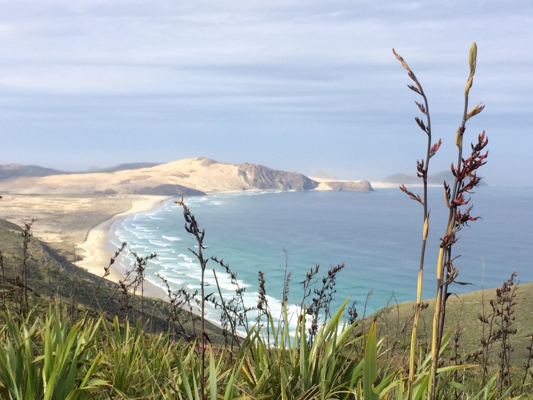
Spirits Bay: around the corner from Cape Reinga
The beach of thirst
A gentle-voiced immigrant from South Africa soon stopped in his white, hard-working ute. “I got out of the corporate world when I met a new partner and we realised we would hardly see each other,” he said, after we’d talked a while.
“Now I’ve got a lawn-mowing business, but I’m essentially retired. It keeps me fit.”
He asked me about family, and I said I had no kids.
He said not to be in too much of a rush; kids were not all they were cracked up to be.
“Like my daughter, she’s grown up now and she doesn’t want a bar of me.”
The move to NZ was partly to blame for the split with her mother, he said. “It doesn’t help when the rand plummets just after you arrive.”
I should take a lot of water with me on Ninety Mile Beach. “I’ve been really thirsty on that beach.”
He took me around the same distance as the other lifts so far, no more than 15 minutes. Inching north, I stood outside the Cooper’s Beach 4 Square with my thumb up.
Secret knowledge
Leo was a big, dreadlocked roading contractor, who filled most of the cab of a huckery ute.
He was on his way to Whatuwhiwhi, one of many Northland places with extremely resonant names, which I was hearing for the first time. Whatuwhiwhi: like the sound of a small wave, breaking over a clump of shining kelp.
It was beautiful, he said, and still cheap. “You can get a section for 80k.” He had bought a bach a few years ago, and spent most of his free time driving from Whangarei to fix it up. “The kids moan though – no Sky, no WiFi. But I make them come.”
He told me the biggest drawback of roading was getting tested for marijuana use. Contractors had to pass one kind of test, which showed if you were impaired by use in the last eight hours; Leo said that was fair enough. But the big firms made you do another kind, which showed if you’d smoked in the last three weeks; if you had, you got the sack.
Leo said that was against human rights. “We should be allowed to take whatever we want, as long as it doesn’t impair us. Like, I don’t drink, but I could get hammered the night before work, and be useless and unsafe the next day, and no test would show it. But if I smoked weed three weeks ago, and got tested now, I’d be totally straight; but they’d still find a trace, and sack me.”
He went right out of his way to take me to Awanui, just north of Kaitaia, stopping outside the village’s only fish and chip shop. “Have you eaten?”
He insisted on paying for my dinner. When I ordered a piece of hoki, he said: “Have some hapuka too – it’s way better.” And: “What flavour thick-shake you want?”
He checked with the woman behind the counter about the quality of the shakes. “Are they real thick shakes? Do you do them properly?”
As we ate he told me he liked to read. History, mainly, and particularly about an ancient civilisation that used to inhabit what’s now Iraq. “That’s why America wanted to invade,” he said. “Because they have so many secrets about life, technology, civilisation. They had to get control of that secret knowledge.”
But no-one knew. “They only report what they want us to know.”
He read a lot while stoned, he said. “And I have all these insights. Sometimes, so I don’t forget them, I put them up on Facebook. And in the morning I’m like, what does that mean?”
But his Facebook friends had grown to like his late-night wisdom. “I say, bro, I wrote that when I was stoned. You must have been smoking up too, if you got it.”
He left me just outside Awanui, and roared off toward his bach.
Looking south from Cape Reinga at the beginning of Te Araroa
I’m not sure where I live
A tired-faced farmer with clear, innocent blue eyes took me a bit further in his beaten-up ute.
Semi-retired, he filled his days labouring for others. Today he had been digging drains. “Otherwise, what would you do with all your spare time?” he asked, shrugging.
He was intrigued about how I came to be hitching around Northland at the age of 42. It seemed strange to him, but there was something about it he liked.
As he dropped me off, at a crossroads called Waiharara in the middle of rolling, empty farmland, he pointed out a house across a nearby paddock.
“That’s me. Well, it’s actually my daughter’s house,” he said.
“My missus and I, we’ve just sort of split up. So I’m not sure where I’m living at the moment.”
I got out, I wished him well and thanked him for the ride. “Nah nah, you too,” he said. “You’re a nice guy.”
A warning
Bridie was kind and motherly in her clean, compact green car. She wasn’t sure what to make of my late-evening hitching.
She took me another few minutes north, to Pukenui. It was getting late, she said, and I should think about camping at the campground there.
“If you try hitching a bit further, and someone offers to take you only as far as Te Kao, say no – they’re not very friendly up there.” She pressed her lips together.
Te Kao: Even the name sounded forbidding to me. But I took her counsel with a bit of salt; Bridie seemed to have a bit of history with Te Kao.
An invitation
I bought some whisky and water in Pukenui, at the last store heading north, then thumbed a ride with Jo, a school teacher. She was only going to the next settlement, Ngataki, in her crumpled white sedan, but it was better than standing around in the gathering dusk.
She was relaxed, capable and cheerful; she loved the north, she loved her job. “Come and stay with us if you get stuck. We’re just down this road.”
She dropped me at the gravelled corner.
The day’s last dog
There were hardly any cars now; I was tossing up between looking for Jo’s house, or curling up in my bivvie bag under a tree, when an expensive-looking black ute slammed to a stop.
A mill worker, who didn’t tell me his name, said it was the bank’s, really.
“My last one got stolen. It was better. But now my payments are smaller.”
He was going to Te Kao. But not only did he belie the shadow of unfriendliness Bridie had cast over his home, he felt sure I’d get a ride from there for the last half hour or so up to the Cape.
He’d spotted a rental car go by as I was getting in, and sped to pass it and get far enough ahead so that I’d have time to thumb it down after he dropped me off.
The mill was good. “Hard work and the pay’s shit, but it’s better than being on the roads.”
He drove hard, fast and well, and dropped me off just beyond Te Kao. “Good luck. Those tourists’ll take you.”
A few minutes after he’d roared off, I saw the bright green rental coming; I raised my thumb. But the tourists just gazed at me and swept by in the gathering gloom, the pale ovals of their faces cool, serene, impassive.
The same went for the next half-dozen cars.
A decrepit dog with the hint of a crazed glint in his eye slunk sideways toward me, balls dangling.
He’d obviously had a tough life, and I wanted to be friendly. But he did look slightly demented. And I didn’t want potential rides thinking I came with a canine.
I chased the lonely dog away.
It was all but dark, and there was no moon yet, and I gave up. I wasn’t getting to the Cape tonight. I knocked on one of Te Kao’s few front doors to ask if I could camp in a paddock.
A tall, muscular man with long hair, movie star looks and wearing only a towel eventually came to the door. He listened with a neutral expression to my situation. “Camp about a ‘k’ down the road – that’s the place that’s been set aside for trampers. You won’t miss it, it’s by the river.”
I tramped along, finding my rhythm on the tar seal. But before I got to the river my last ride arrived.
The last house in New Zealand
Phyllis, a young mum in a tidy four wheel drive, told me she’d take me to the last settlement before the Cape, Waitiki, where there was a campground. “You’ll easily get a ride from there in the morning.”
But first, she said, I’d have to come with her while she picked up some mower blades from her mum – if she could find her. “She’s not home, and not answering her phone.”
The first place we looked was a three-walled shed with a bar, fridges, arm chairs and an outdoor barbecue area. It turned out to be a kind of elaborate person-cave for shepherds from Te Paki station.
“Lucy! Stop being hoha!” bawled one of them at a huge dog, which barked mightily at me when I got out for a look.
“Kia ora bro,” said another shepherd. “Just touring around eh?”
Phyllis’s mum was at a nearby house. She handed over the blades and we were off to Waitiki.
On the way, Phyllis said that in the morning, I’d pass her and her husband’s home, just north of there.
“It’s the first or last house in New Zealand, depending how you look at it.”
She often picked up hitchhikers heading to or from the Cape. “My mum says, when are you going to stop picking up tourists? But I think, if it was me in another country, I’d want to get picked up.
“People think it might be dangerous, with being a woman and that.
“But I don’t think anyone would do anything, not up here.”
There did seem to be something different in the air up here, with the low, scrubby, ocean-hemmed hills rolling by.
She told me the names of each of the iwi-owned stations as we barrelled past their boundaries, invisible in the dark. “That’s the end of Te Paki… this is Paua station…”
The farms had gradually been returned to the five Far North iwi since they negotiated a Treaty settlement, she said.
“It’s all back in our hands now… it wasn’t perfect, but if we didn’t accept the settlement we might have had to wait another hundred years.”
There was one station still owned by a Pākehā family, who had had it since colonial times. They had refused to sell, she said. “Their land goes right down to Ninety Mile Beach and they have a bach there. They like it here too, they want to stay… we get on OK with them.”
It was good having the land back, and with it not just jobs and income, but also mana.
“But some of us still go away for work – my family goes out on oil rigs.” An uncle was on a rig off Singapore. “He likes it – the money’s good.”
She said she liked the idea of the walk, and thought it was good that people came to see the special place where she lived. “But they don’t always respect it. There are caves up there, by the Cape, where people were buried a long time ago. We tell them not to go in there, but we know they do. And we think OK, that’s your problem – if you want to mess around with tapu…”
She dropped me off at the Waitiki campground, and we exchanged names as we shook hands in farewell.
“That was my Gran’s name,” I said. “And you’re the only other Phyllis I’ve ever met.” She smiled, composed and gentle.
I lay down in my bivvy bag under a tree and slept like the journeying dead.
The end, or the beginning
Soon after sun-up a retired Pentecostal pastor who’d stayed nearby in a caravan with his wife came to say hello as I brewed coffee. “We’re going up to the Cape after breakfast,” he said. “We can take you.”
The landscapes rolling by in the early morning sunlight seemed spooky to me: low hills jumbled together at strange angles, covered in crouching, dark scrub.
The tar-seal road wended its way through them like a sophisticated intruder.
Finally, I was there: the start of the trail, the end of the country.
It’s a moving place. It’s sacred for Māori: legend says here is where the spirits of the dead move from this world to the next.
It had been a tricky, long, tiring and piecemeal journey. On the way, standing in hot sun on desolate roadsides while sporadic traffic hammered by and travellers gazed at me with disdain or indifference, I sometimes wished I’d taken a simpler option.
I could have driven to Kaitaia and paid $35 for a seat on a tour bus. I would have been at the lighthouse by yesterday afternoon.
But this way felt right somehow – as if finally reaching the top of your country after 42 years should not be a straightforward task.
As if pre-packaging such a journey, complete with lunch and a worn-out commentary over a bus’s sound system, would not do it justice.
As if you should have to struggle for it, get there bit by bit, by chance.
As if you should pass through the hospitable hands of many drivers, like so many gatekeepers, sharing with them the reasons for your trip over and over, gaining new angles, hearing their stories too, learning what you had in common and what you didn’t.
Also, with the Cape being the beginning of Te Araroa – a 3000-kilometre trek through the length of my country, which might take me a decade – it felt right that it should cost some work and patience to get there, and be contingent on the generosity of strangers. All of those things would be needed to get me to the other end.
When you walk through the gateway between the parking area and the path down to the very tip of the Cape, you break some kind of beam, activating a recording of haunting Māori flutes and chants of welcome, of blessing perhaps, of warning even of the specialness of this place to its custodians.
It moved me to stand just beyond that gate and see, for the first time the furrowed seam where the Tasman Sea and Pacific Ocean meet. I’d made it to the ends, or beginnings, of my piece of earth.
I got talking to a couple of Brazilians, who had recognised my Fluminense football/tramping shirt. “Ufff, que lugar,” one of them said: “Wow, what a place.”
It really is.
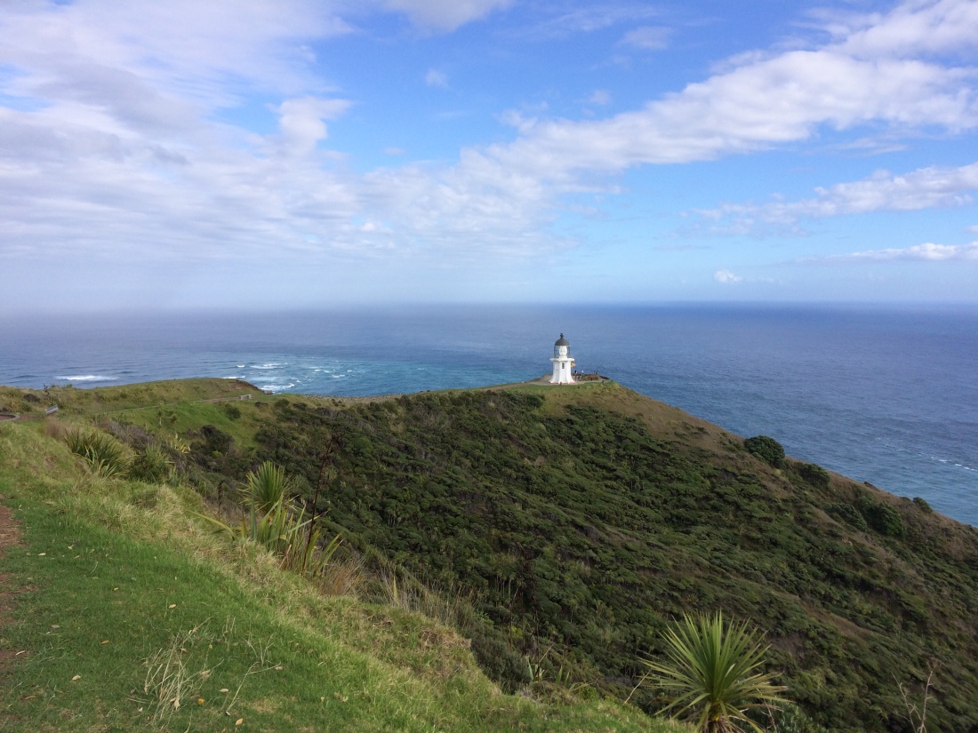
Cape Rēinga is a lot more than a much-photographed lighthouse.
This is Te Rerenga Wairua – the original name of Cape Rēinga. The name refers to the place where the spirits of the dead depart for the next world, in Māori cosmology.
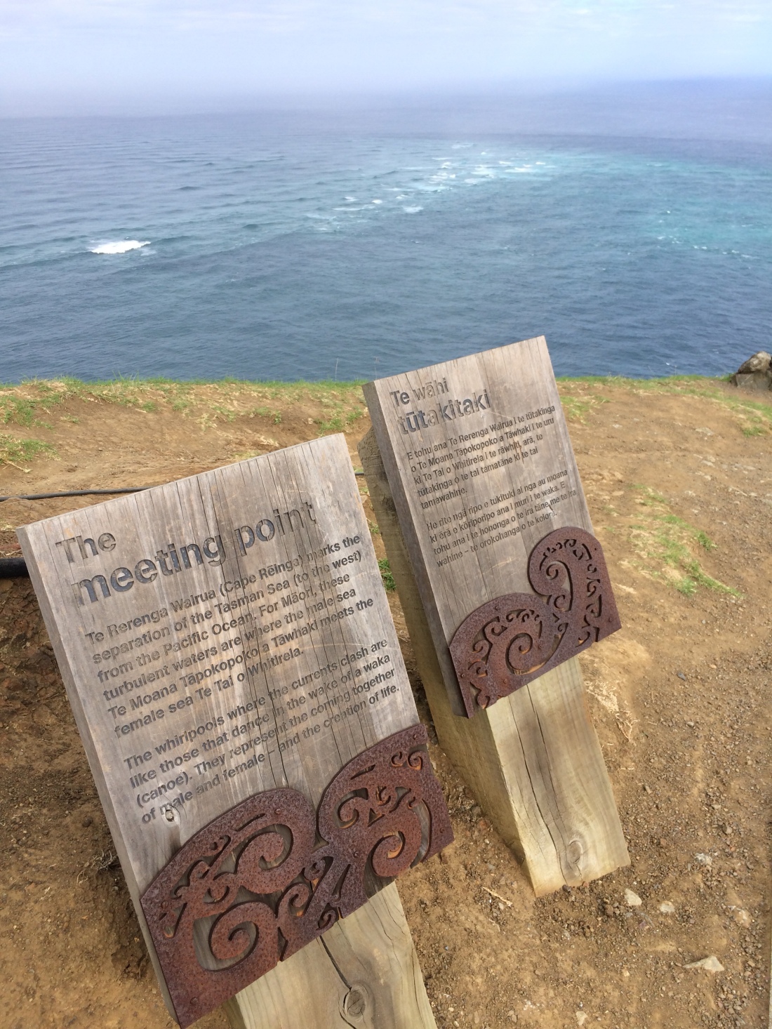
I liked the brief, thoughtful information panels outlining various layers of meaning this “what a place” held for Māori.
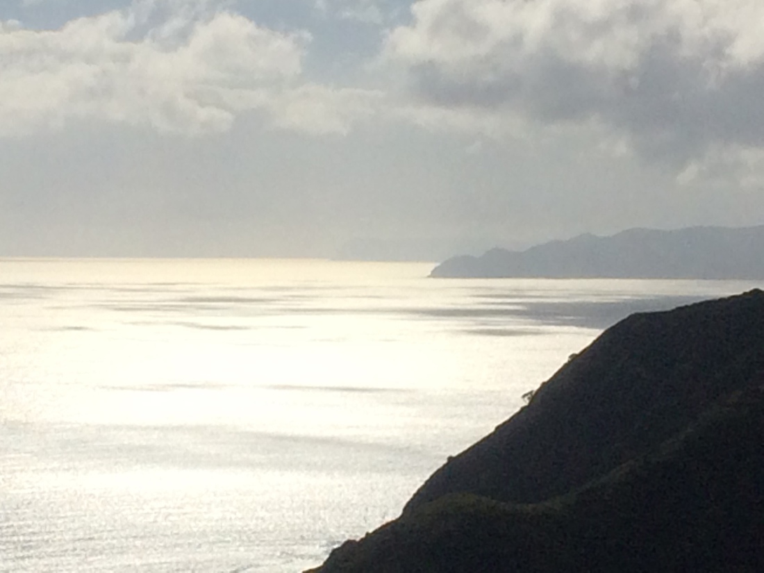
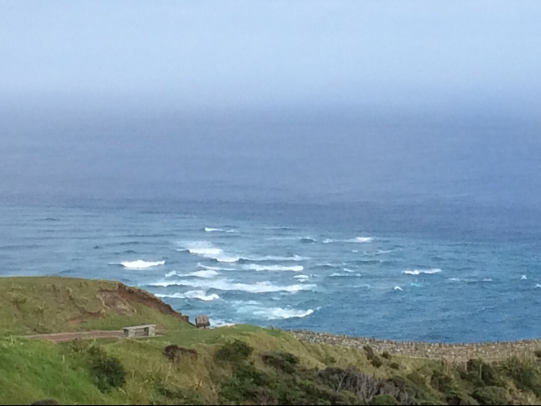
One was about how the Tasman Sea and Pacific Ocean famously meet just off the Cape, in a long, seething line, a dramatic sight, like two flat avalanches colliding in slow motion.
This pic doesn’t do the meeting of the Tasman and Pacific even a skerrick of justice.
The panel described this tremendous blending of sea and ocean as symbolic of what can happen between lovers – a beautiful, but explosive encounter of equal forces, each asserting themselves fully, yet also being changed utterly by the other.
I sat a long time watching the diagonal lines of swell continuing on their contrary ways after that encounter, implacable.
This one captures it a bit better – the two contrary, massive currents sweeping in; their clash like a smashed road out to the horizon.
The Tasman swells somehow recomposed themselves after all the noisy splattering, and kept moving stolidly north-east.
The Pacific swells pulled themselves together too, and emerged from the swirling fracas to keep rolling purposefully south-west.
I liked another panel describing the origins of the name of nearby Spirits Bay (Kapowairua). When an ancestor was about to die, he told his loved ones that his spirit would soon pass them, heading for Cape Rēinga, where all the spirits of the dead depart this world.
When that happened, he instructed, they must do one, final, crucial thing for him:
“Catch my spirit!”
I liked the one about the ancient pōhutukawa tree, or kahika to the locals. Wizened with uncountable years, it hovers between life and death on the very edge of the rocky point below the lighthouse; it’s from this rocky point where the spirits of the dead are said to step off this world.
The ancient pōhutukawa that is said to provide a ladder from life to death is the small green speck to the right of the bare outcrop.
Their very last steps are down its gnarled roots, which grip the permanently wet, shadowed rock just above the water line.
The tree’s name, the panel said, is Te Aroha: Love – the ultimate frontier.
But it has never been known to flower – as if such sombre duties preclude ever showing off such an intense, joyful scarlet.
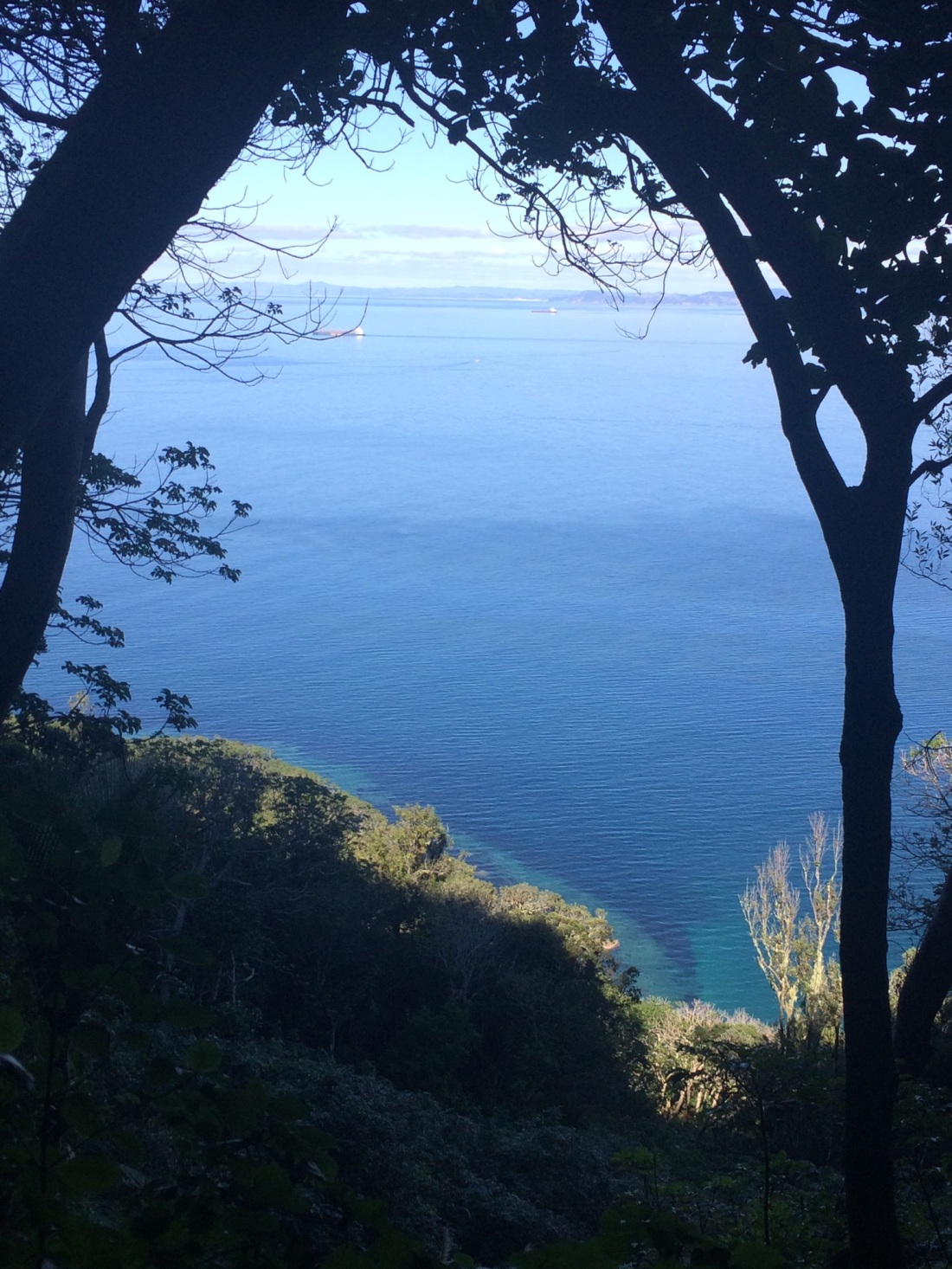
From just above the lighthouse I got my first view of Te Araroa – the track drops down off the Cape and onto a small beach to the south. From there, it’s another 3000 kilometres to Bluff in the southernmost tip of the South Island.
The first camp is at Twilight Beach, 12 kilometres south of the Cape.
It was harder than that distance sounds because the trail notes said the Twilight Beach DOC campsite might run short of water in midsummer, so on top of four days’ food and all my normal gear, I was carrying a two days and a night’s water – nine litres.
This boosted my pack weight well over 15 kilos, a lot for a hot hike over scrubby headlands and through soft sand.
But I got there, and there was plenty of rainwater in the campsite’s tank. And an idyll awaited: another tramper, curled up asleep in a mosquito-mesh tent, pitched so its door commanded a stupendous sea view.
Her tent looked a delicious place filled with soft sunlight, afternoon breezes and peaceful rest.
Later, over a whiskey, we chatted. She said working as a ranger on Norfolk Island was rewarding, scenic, but a bit lonely. “It’s lovely… but just so small.”
As the sun went down I sat back with a book, a liquorice tea and all that twilight: great curtains of sea mist hanging above endless combers, shot with gold.
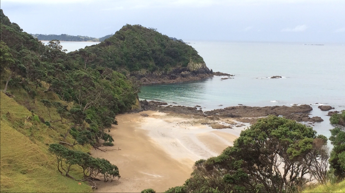
Twilight Beach, taken from my first campsite on Te Araroa: a piece of Department of Conservation paradise about 12 kms south of Cape Reinga.
In the morning she headed north toward Spirits Bay, and I carried on south, toward 90 Mile Beach and, eventually, the rest of Aotearoa.
Sometimes, the trail emerges on the landscape, like a visible companion.
I wouldn’t meet another tramper, going either way, for nearly five more days on the trail.
Are beaches the best places in the universe to read and think?
That’s the claim of a Latin American writer – maybe Borges? – whose name I’ve forgotten.
Beaches are huge, blank canvasses on which we can pour out dreams, monologues and interior inquests, he or she says.
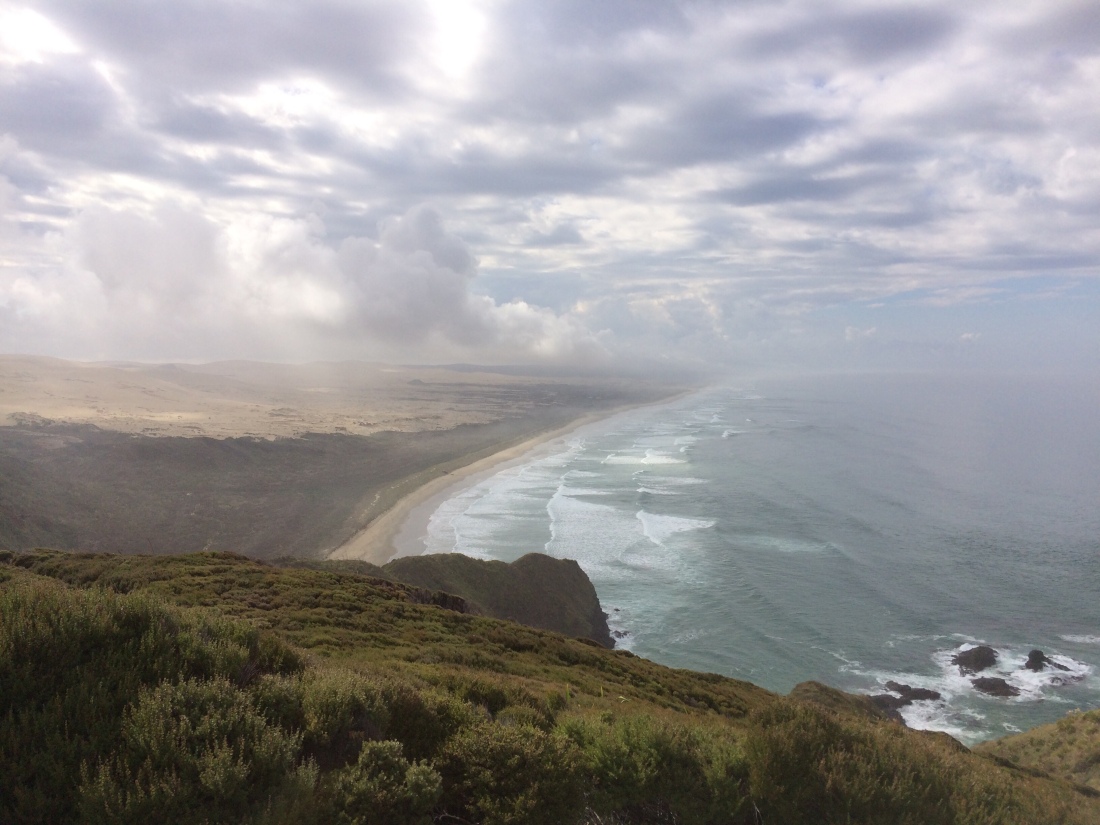
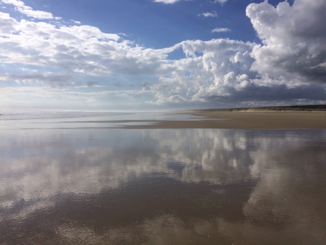
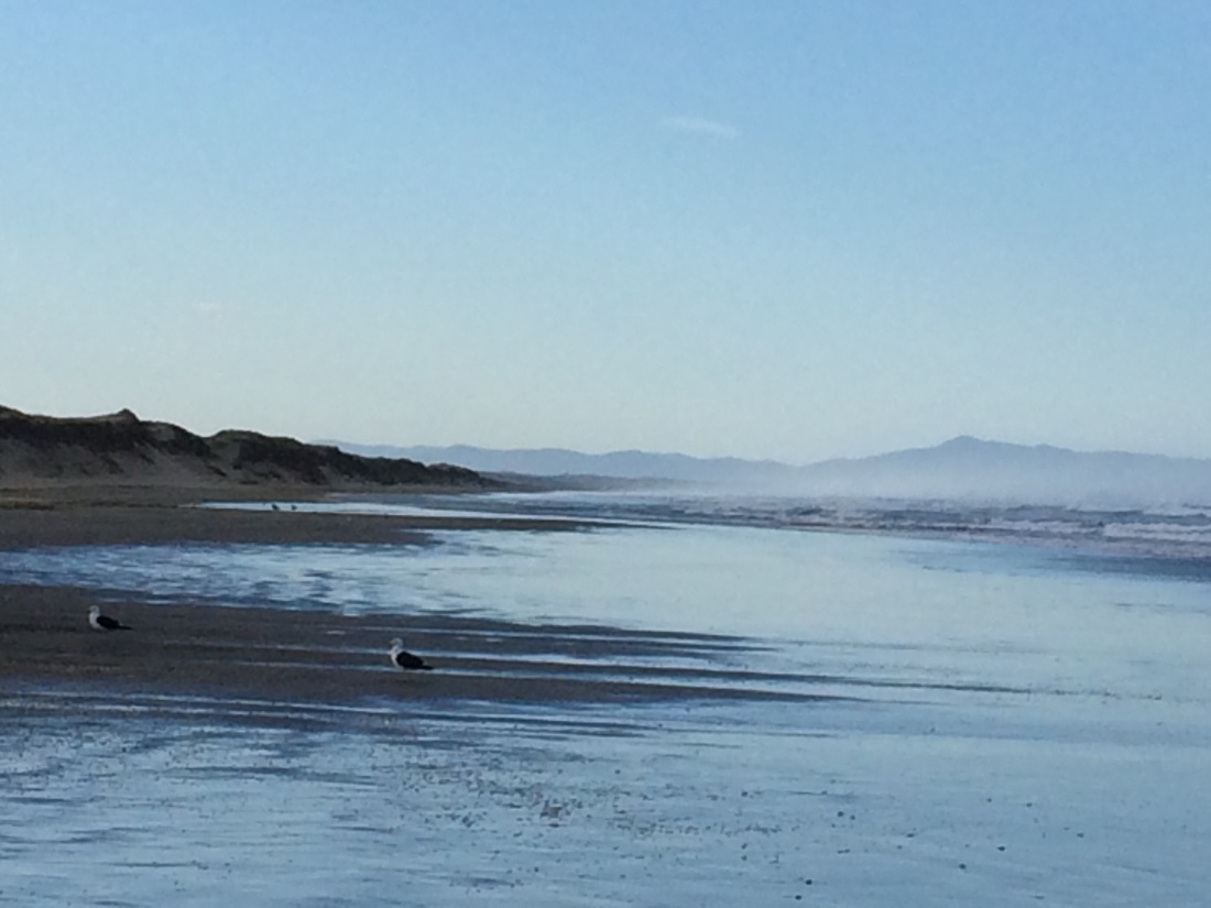
That being so, Ninety Mile Beach in New Zealand’s far north must be among the world’s premier reading-and-musing beaches.
Because, while not literally ninety miles long, it’s not far off it, and it has a mighty, beautiful blankness the like of which I’ve never felt before.
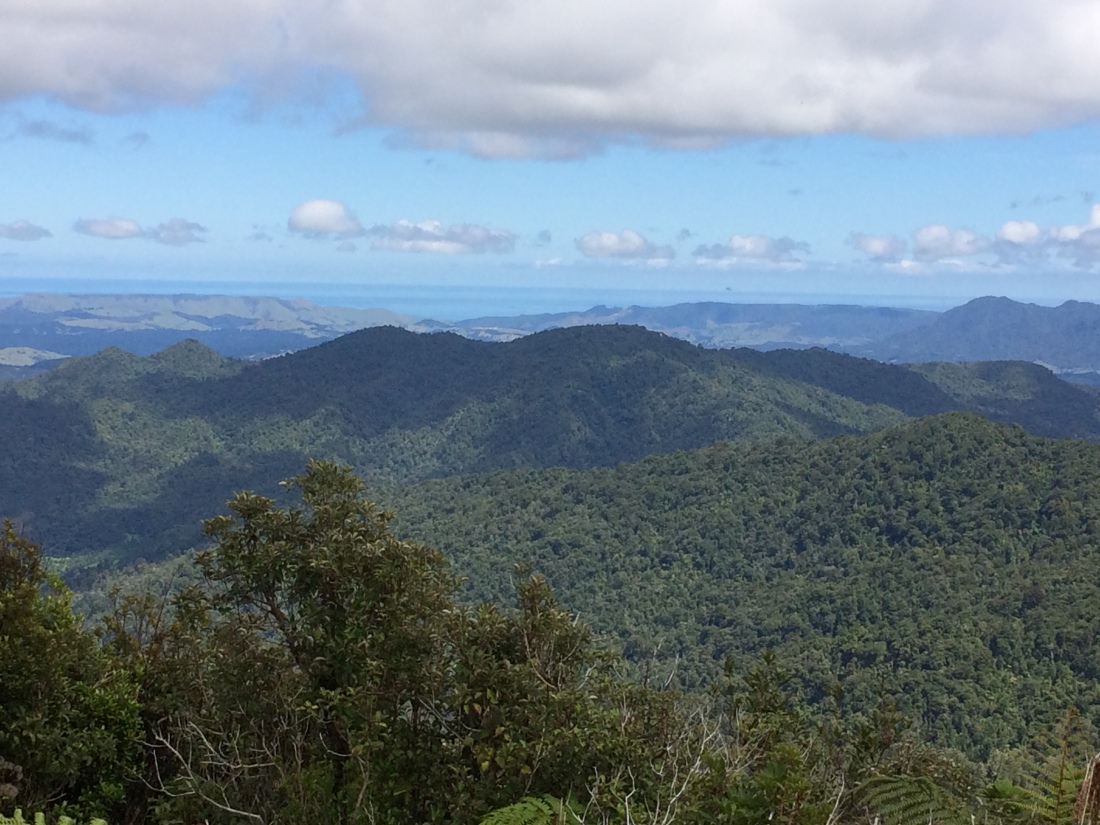
Day Two – Twilight Beach campsite to Maunganui Bluff campsite: 28km
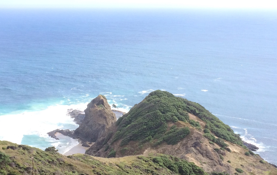
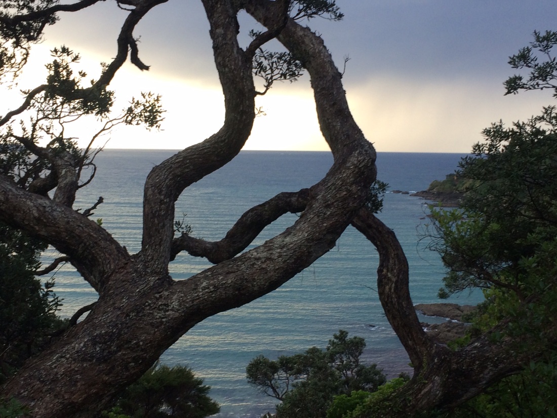
This is how Ninety Mile Beach looks the first time you see it on the Te Araroa trail, when you reach the top of Scott Point, a few kilometres south of Twilight Beach and Cape Maria van Diemen:
That great length of sand disappears into the horizon like a two-dimensional, horizontal cliff.
It’s even intimidating in print: nearly six pages of Te Araroa maps are nothing but beach, an almost unwavering white line drilling relentlessly down the margin, washed by a million paper combers rolling endlessly in from paper Australia.
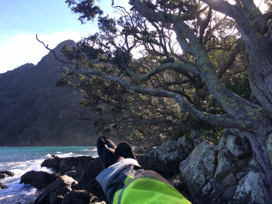
The headland I took this pic from is an hour or so south of Twilight Beach, along sandy tracks through low scrub. My pack was lighter without all that water, but it was still a hard slog up.
But I knew it was the last climbing I’d do for a few days; after that, the beach is almost completely unbroken by ups or downs, a long, gradual, flat crescent. The only bump is Maunganui Bluff, a low outcrop 25 kilometres south of where I took this pic. There’s a stream there you can drink from; that’s where I had to get to by evening.
I was carrying four litres of water, which would only last that far.
There are creeks along the beach, but they’re tidal, or dry in midsummer, so you’d have to trek far up to get drinkable water. There are no settlements on the beach, so the only other option is to trudge a couple of hours up through scrub or farmland to the road.
The first time in my life I saw Ninety Mile Beach was from the air. I was 24, and on my way to teach English in South Korea. It was also my first time travelling further away than Australia. That massive beach curved away behind the plane, a long, golden, goodbye scarf.
It’s got its name, it’s said, because it took a pioneer three days to traverse by horse and cart; he knew the horse could do thirty miles a day, and christened the beach accordingly. But that beach has a habit of doing funny things with time, and he’d actually only managed 18 miles daily; a total of 88 kms.
If he’d been French, and less optimistic, he might have got closer – but “Ninety Kilometre Beach” doesn’t roll off so neatly.
The Māori name is more precise – Te Oneroa-a-Tōhē: the long beach of Tōhē.
Tōhē was a chief of the the Ngāti Kahu people, who has at least three lovely claims to fame.
One is the “catch my spirit” request he made of his descendants, described in a post below.
Another is that he gave names full of music and meaning to pretty much everything in this region – headlands, hills, islands, streams, beaches.
(Speaking of which: part of the potent charm of the far north is that it is an area of Aotearoa where the original Māori names, like Tōhē’s, have largely resisted the galloping nomenclature of invading Brits. So instead of honouring alien bishops, patrons and politicians of questionable honour, and with little or no connection to this beautiful place, Northland’s names tell truer stories).
The other cool thing about Tōhē is that he was, you could say, one of the first trampers.
His final act in life was to walk along this same beach, one he’d walked up and down many times, naming his world.
He knew he was dying, and wanted to do something bittersweet one more time before he died: take a last look at his treasured daughter, Rāninikura. She had married a man from down the coast.
Tōhē didn’t make it that far, reaching only the bluff I’m headed for today.
So I salute him from Scott’s Point and dive down into that linear, salt-washed desert.
Some walkers say the long beach of Tōhē is boring; it’s just a three-day yomp down a sandy highway, they say, the scenery never changing, your circulating thoughts driving you spare, nothing to distract you from your blistering feet and jolted joints, which are nearly shaken loose by the unrelenting grind.
I couldn’t disagree more.
While that colossal blankness and fabulous spaciousness do have their demanding side, I’m with the poet Larkin on this:
Such attics cleared of me! Such absences!
Larkin would have gorged on such space, such absence
The emptiness lets you hear your real thoughts, not the habitual, scrabbling ones.
And the radical lack of anything, anywhere made by humans, and how small you are in the face of so much sand, water and sky… it seeps into you.
And you start feeling there’s no actual separation between you and the big beach.
Which is anything but repetitive; it’s endlessly changing. There’s the tide; the sun, the light, the weather, the clouds, the waves, they all do their enormous, inventive thing.
Then there’s the tidal drawings on the sand, the beach’s colour and texture, the birds, crabs, shells, fish, seaweed, the length and shade of the dune grass, the falling and rising line of the dunes, the creeks that come and go…
Yet another variation of Te-Oneroa-a-Tōhē’s endless palette
I came around a dune at one point, by a creek, to find a mob of wooly, red-coated, wild horses. They looked at me with shining eyes.
And another time I found this guy, among the dunes:
He flopped out of some flax in front of me, paused, casually boarded my held-out hand. Regarded me gravely while I took a pic. Hopped off, darted away; had shit to do.
Sometimes the beach is a sunny, bronzed highway; other times it gets grumpy, apocalyptic even:
Sometimes it’s hard to tell where the sky ends and the water starts.
Or the sand.
Or you:
Sometimes I had to pull over, dig my journal and some biltong out of my pack, and write for a while.
Or just stare at the horizon.
I’m with Borges, or whoever it was: beaches do that to you.
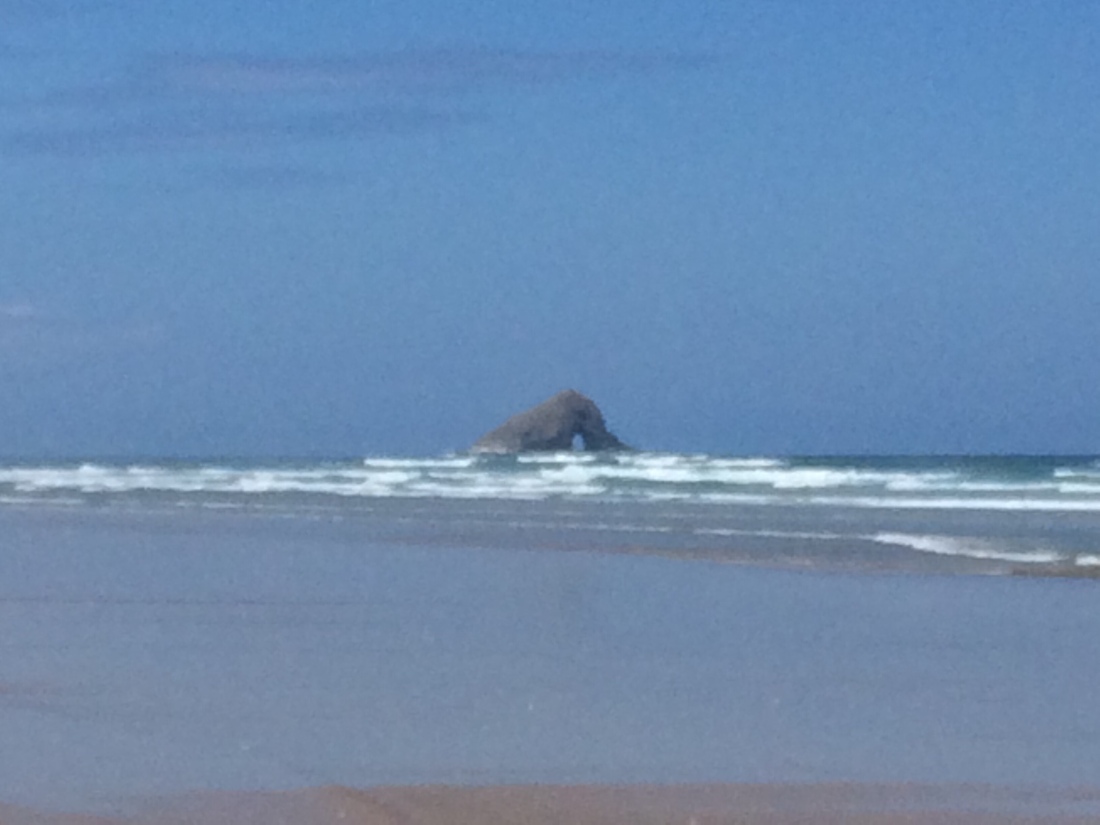
The only other feature to interrupt the spacious blankness of the beach, apart from Maunganui Bluff, is Matapia Island – which also appears on the first day.
It’s a mystery at first, a hazy blob. As you draw very slowly more and more abreast, over a couple of hours, it sharpens, defining itself bit by bit against all the emptiness.
It’s educating you on how to move along the curve of the earth, with the soles of your feet, your lungs, your sweat; how to dream while walking, as a dog or horse does; how to move like a part of the planet, not dislocated from it, not disdainful of the dirt and blood of it.
After a long time, you round Matapia’s shoulder, one minuscule pace at a time – your little yard, your minor metre.
Then, startled, you can see right through it – it has a hole, which you can only see from this angle.
I learned later that same hole gave it a beautiful name, one that Leonard Cohen might have liked, with his idea that
There is a crack in everything that’s how the light gets in.
According to The Tribes of Muriwhenua: Their Origins and Stories by Dorothy Ulrich Cloher, the island was named Matapia – shining face – by Tōhē (of course). He called it that because his servant Ariki saw that hole shining through mist, and said:
The hole of a face is shining at me.
After another long time, the island is no longer beside you on the horizon, but over your shoulder; and you feel relieved that you are actually progressing down that long, golden line.
Finally, 28 kilometres from Twilight Beach, I reached the Bluff; exhausted, thirsty, thrilled by the sunset.
The campsite is run by a local trust and is pretty basic.
The water source is a pipe which directs a stream into a bathtub; the toilet is… best left undescribed.
But the twilit sea was delicious to jump into after walking all day.
And a dinner of two-minute noodles and tuna tastes amazing with the sound of the waves and the Tasman breeze.
Day Three – Maunganui Bluff campsite to Utea Park campsite (30km)
In the morning I got away early: 30 kilometres was going to test a tenderfoot like me.
The changing tide varies your day, but also toughens the challenge.
At high tide you find yourself slogging through soft sand near the dunes, or sloppy sand further down.
Some 90 Mile Beach hikers have even slept during the day and tramped by moonlight, to get the best use of the low tides. Day worked better for me, with high tides around dawn.
I daydreamed the second day away in a salty daze, watching the universe tick by, a step at a time.
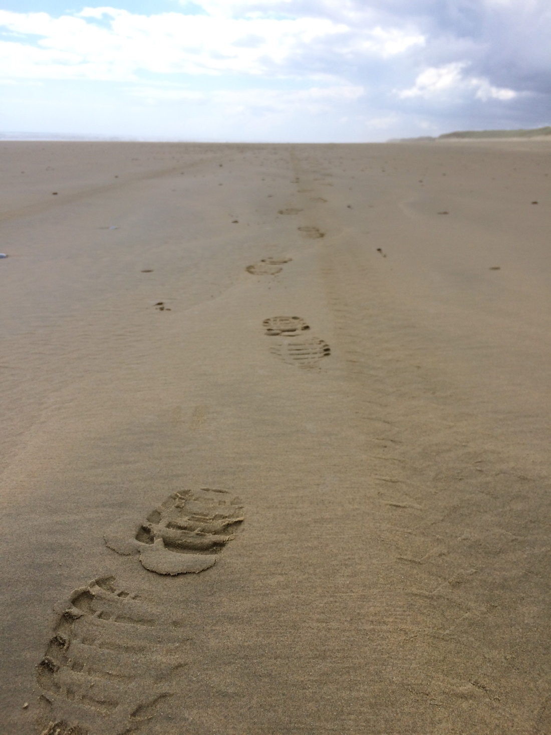
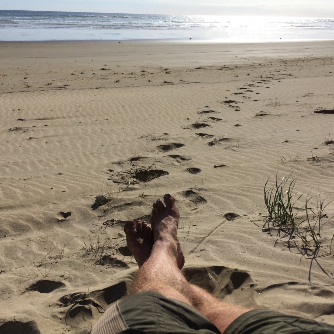
My boots, cheap ones I’d hoped would get me through one more tramp, were not up to the task; I had bad blisters already. I did long sections barefoot; it was especially good at higher tides, sploshing along in the foamy wash.
Your analytical mind switches off, and you think and feel and live with your whole being, as it steps along the broad wet sweep of the world.
I thought about all kinds of things. You have time, and space, and fresh air, to do a lot of considering, remembering, digesting, feeling. Things you shut away a long time ago can surface; you can watch them emerge, and take them in.
Meanwhile, your feet and legs and arms attached to walking poles keep steaming away, finding a rhythm.
It’s a really incredible way to spend a day.
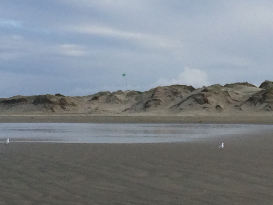
But nearing nightfall, my feet were throbbing, and my shoulders under the pack, and my mind. I was out of water. I’d had enough, had been walking for 12 hours, and was hanging on, searching for some sign of Utea Park campsite.
Then I saw this ragged green flag appear above the dunes:
I stumbled wearily up through the soft sand; young people in jandals and sunglasses started appearing, watching the sunset, drinking beer.
An English couple sitting arm-in-arm beneath a dune pointed me up a sandy track.
A cluster of quaint wooden cabins appeared, some vans and tents, a communal kitchen from which poured music, chatter, the smell of seafood cooking.
I flopped onto a seat, shattered, happy. An older, bearded guy waved from the balcony of his cabin: “Oho! We have a walker.”
He came over a put a cold beer in my hand. “Good trip?”
Two German backpackers, Flo and Eva, joined us. They were fascinated by Te Araroa too. “What’s it like?”
They gave me a big plate of steamed tuatua – a delicious shellfish you can dig from the beach here; a specialty of Utea Park.
The proprietor Tania, who belongs to the local iwi, teaches campers how to find them; the camp’s driveway is paved with their crunchy shells.
The older guy, a retired Canadian sailor, kept plying me with Steinlager, and Flo and Eva with tuatua. Tania came over for a yarn too, and the English couple from the beach. It was a very still, mild night; the stars came out above Utea, Tania’s ancestral hill, which rises whale-like among the dunes beside the camp.
I hadn’t moved since I arrived; I was happy, full, and charmed by the company and the setting, and thought I might never move again.
We talked til after midnight. Then I had a hot shower that just about made me weep with pleasure, fell into one of the cabins, and passed out as if shot.
Day Four – Utea Park to Ahipara (31km)
With hindsight, I wish I’d just walked to the next campsite, Waipapakauri, 17km down the beach – I was shot to pieces by this stage and could have done with an easy day.
Instead I pushed through to Ahipara, another 14km further on, and ended up putting in about a 14-hour day on my blistered, throbbing feet. I’m not sure what I was trying to prove, or to whom.
One factor in the decision to keep going was probably this notable change in the view, which emerged soon after leaving Utea Park:
It’s the end of Ninety Mile Beach – the headland beyond Ahipara, the finish line, the seductive sign that you’ve made it down that immense stretch of space, of absence.
It drew me on, beguiling me into keeping plodding when I had nothing left.
Closer now to civilisation, there were more fishermen, appearing in utes or simply standing in the surf, contemplating absence perhaps, or dreaming of snapper.
Occasionally farmers drive by too – the beach is a legal road, and the locals use it to shoot up and down between paddocks or to commute into Kaitaia or Ahipara.
The most incongruous traffic, though, is the tour buses. You’re wombling along in a dreamy, contented, painful blur, when you become aware of a mechanical keening, a diesel hum; you whip around, lest you become road kill, and see the juggernaut in the vast distance, a mirage wobbling between sea and sky.
The bus grows bigger, til it rockets past, tourists faces white blobs against the glass or facing the front, indifferent, earbuds in.
As the metal box diminishes I trudge on, thinking that my way hurts more, but I like it better.
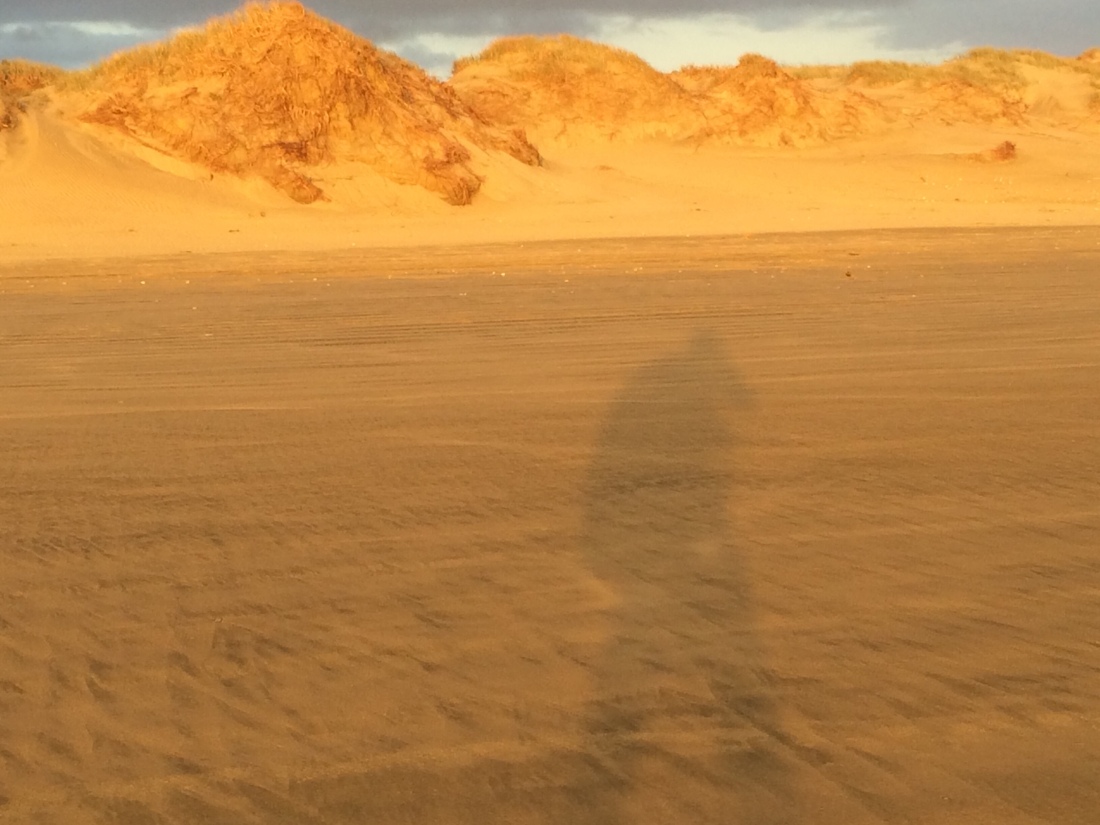
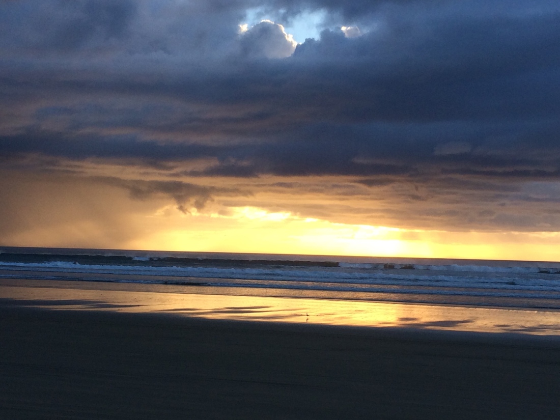
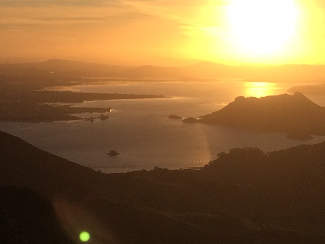
When I neared Ahipara I saw the “standing fire” sunset in the exhausted, thirsty, semi-delirious state described in an earlier post.
But by the time I got to the sandy ramp up into the town itself it was dark, and I found my way up the ramp by torchlight.
Staggering out onto the road I passed a parked carload of teenage girls, who appeared to be watching the moon rise over the sea while hot-boxing. One wound down a window, and a fragrant cloud emerged.
“Tēnā koe, e hoa,” she said. “Where have you come from?”
The Cape, I said, swaying.
“Oh, true? Mean, bro. How long did that take?”
Three and a half days, I said, forcing my tongue to move in my dry mouth. “Oh, good one, bro. They usually take longer than that.”
I felt ludicrously proud.
The girl in the driver’s seat craned past her friend so she could meet my eye. “Kia ora, matua,” she said.
At this term of acknowledgement for an older person I felt both touched and dismayed. Are my whiskers that white?
But mostly touched.
I thanked them and tottered on. After 14 hours and 31 kilometres, the extra kilometre to the YHA campsite seemed an exaggerated torture.
But finally I made it. It was nearly 10pm. I went to the communal reception and dining area, which was full of light, and families and couples dining, playing cards or drinking. I imagined the sensation I was about to make, covered in sand, salt and sweat, bearded and battered, exotically burdened, many miles of empty sea filling my eyes.
But when I walked in, barely a head bobbed; and those that did went straight back to their cards or steaming cups.
No-one cared I’d just walked 100 kilometres.
But that was OK.
Soon I was crawling into an upper bunk, ecstatic to be horizontal. Drifting off, my mind’s eye was full of that immense canvas that was now, for me, anything but blank.
I spent my first rest day on the Te Araroa trail lying in the sun, eating biscuits, grinning with relief at being horizontal, and reading the Murakami novel I’d lugged from the Cape.
A decent book is the one heavy luxury I’ll put up with lugging.
Having had a good hiding from Ninety Mile Beach, I rested up at the Ahipara YHA for three nights.
On the second afternoon I pulled myself together enough for a short hitch-hike into Kaitaia to buy some new boots. I also needed to resupply at the supermarket with noodles, biltong, almonds, peanut butter, tuna, dehydrated peas and the rest of my tramping menu.
(I’ve put a bit of thought and research into the menu; it’s long on fuel-rich fat and protein, and short on weight. Carrying your house on your back teaches you to respect every gram. And you can always vary the spartan diet every few days when you reach a town.)
Walking to the edge of Ahipara (which has neither boots shop nor supermarket) I came to a health clinic, its door open to the sunny morning. A lovely nurse with ancient roots in that district bandaged my blisters, and told me how much she’d relished moving home to look after her people.
After that, I got a ride just as fat rain began to splat on the hot seal. A young couple had burned past, braked, swung back in a u-turn; an arm had reached back to open the back door. “We decided we couldn’t leave you there, with the rain starting,” the freckled, red-headed woman grinned.
Kaitaia is a bit of an anomaly. It’s the main town in the far north, a region with two spectacular coasts, defined by its touching slenderness in the midst of all that water. But you can’t see the sea from Kaitaia, nor even smell nor hear it. It feels utterly inland.
Still, it has its own gritty, unpretentious charm. And the Hunting & Fishing shop sold me some fairly decent boots for a good price. “They’re not the greatest of boots,” the clerk confided. “But they’ll get you through those forests.”
After heading pretty much due south for its first 100kms, from Cape Reinga to Ahipara, the trail strikes off west for the next hundred or so, straight across the island to Kerikeri.
It links DOC tracks, a new track built by the Te Araroa trust, farmland, forestry roads, back-country gravel roads and a short stretch of State Highway 1.
And three forests: Herekino, Raetea, and Omahuta-Puketi.
I walked back into the YHA dorm with my shopping bags, and began, somewhat wistfully, to prepare a packet dinner in the shared kitchen. I’d run out of time to have a better meal in town.
But then I got chatting with the some other travellers; they loved the idea of Te Araroa. “Want some fresh snapper?” asked one. “Caught it this afternoon.”
I sure bloody did.
“Want some rockmelon, pineapple and watermelon?” asked another. “Bought it this morning.”
Oh, hell yes. This type of thing (strangers being lovely to you, because you’re doing A Cool and Arduous Thing) is known in the long-distance hiking community as “trail magic”.
And it can be so sweet.
Day 5: Ahipara to campsite by stream near end of Herekino forest – 18km
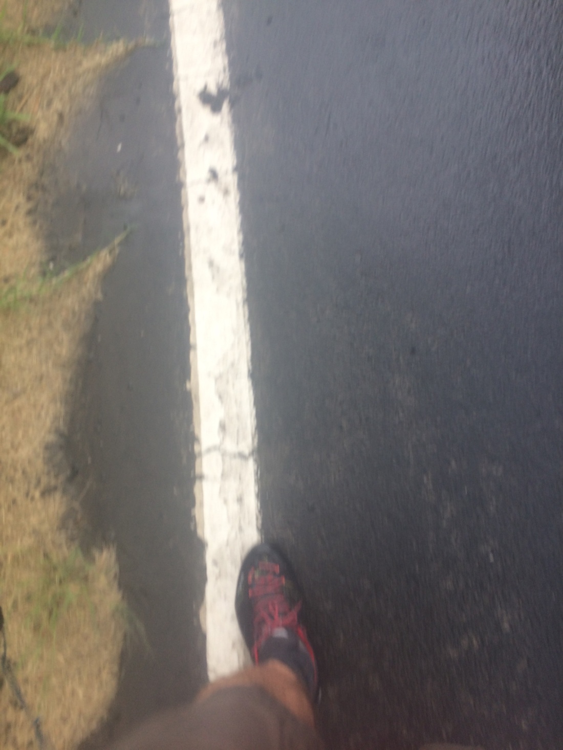
I got away at dawn, my feet much better with their new tyres, my walking poles plinking pleasantly on the tar seal past the school out of town.
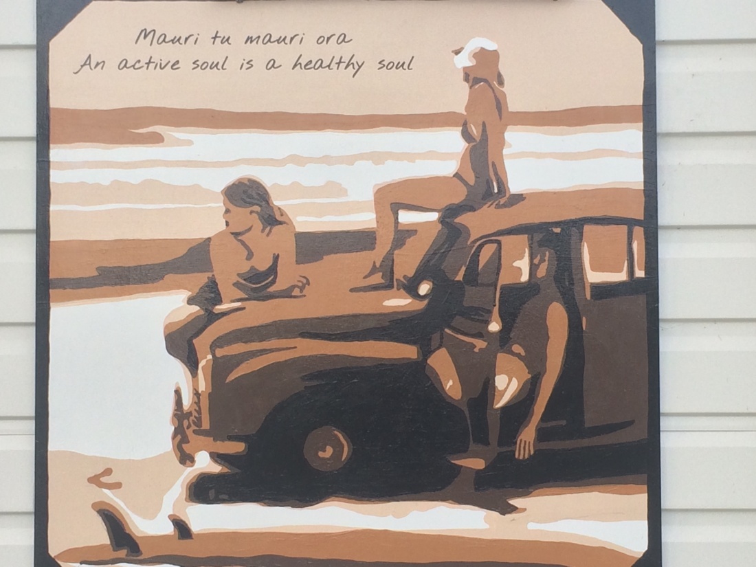
At the school, a mural seemed to sum up a possible point of walking the length of NZ (as if you’d need a point):
This is a bit like “Tama tu tama ora, tama noho tama mate” – in my loose translation: those who stand up live; those who sit around die.
It took me two or three hours to wind my way up into the bush-covered hills south-east of Ahipara. At the top of the hill there’s a saddle, where the road carries on towards Hokianga.
On my way up I passed an elderly couple sitting in an little, old cottage; they were getting ready for their day. He was sitting at the kitchen table in a checked flannel shirt and a patch of sunlight, staring at a newspaper; she was in the next room, wearing a shawl and an old-fashioned dress, making a cup of tea. As I walked by, she went out of view, reappeared in the room he was in, and put down the tea; he looked her in the eyes and gave her a wordless, crinkly grin. They didn’t see me go by.
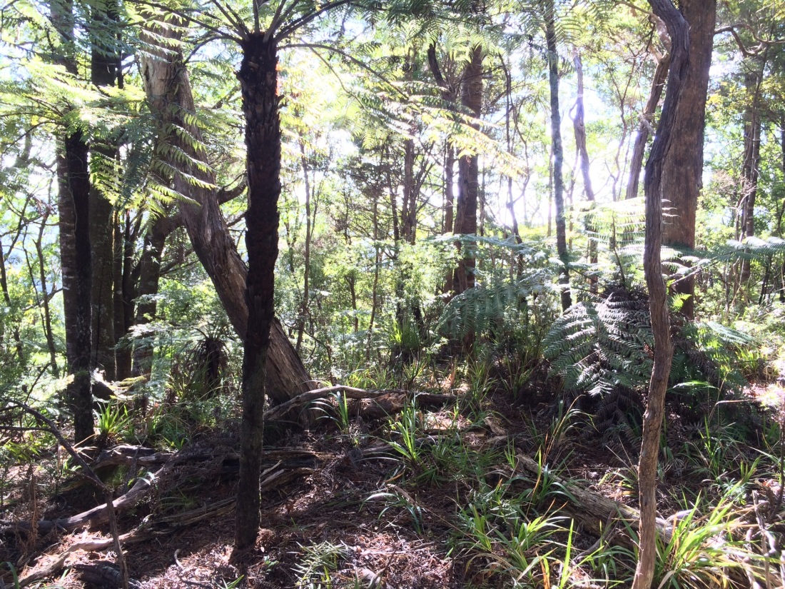
The track strikes off from the saddle, and you are into the first of the three Northland forests: Herekino.
It’s a delight to feel the familiar, dark green leaves close over you, and the roots and mud under your boots, after those hard-boiled beach days.
Soon you come to a grove of huge, ancient kauri.
These are a special tree for Kiwis, and Northlanders in particular. They can live up to 2000 years, and reach a height of 40 metres and a diameter of four metres, or more. Awesome groves of these giants used to cover much of the north.
Māori revered them as the king of the forest, because they tower above all others; Europeans valued them too, for shipbuilding especially, and bowled just about the lot.
Māori skittled a few, too, mainly for waka; but there’s no doubt they did it a lot more sustainably, that is, with a lot less crazed, mechanical abandon.
There are only remnants now, like the Herekino one. But they don’t lose much power for being remnants.
It’s not often you stand next to such a genuinely colossal living thing. It’s like swanning along in the sun-dappled bush, only to suddenly find yourself in the presence of a silent, silvery whale, standing on her tail, surveying the axe-bludgeoned world.
The track weaves on through the damp bush, torn up in places by wild pigs looking for roots and maybe native snails – the partly-chomped black whorls of their huge shells appear sometimes beside the rucked-up earth.
You go along an old forestry road for a while, dating back to the kauri felling days; old forester’s huts are mouldering into the wilderness along the track, ghostly and wistful, lost.
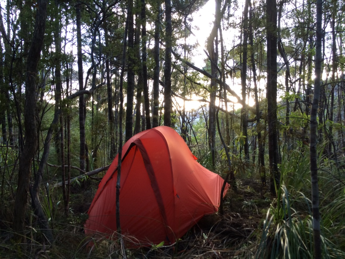
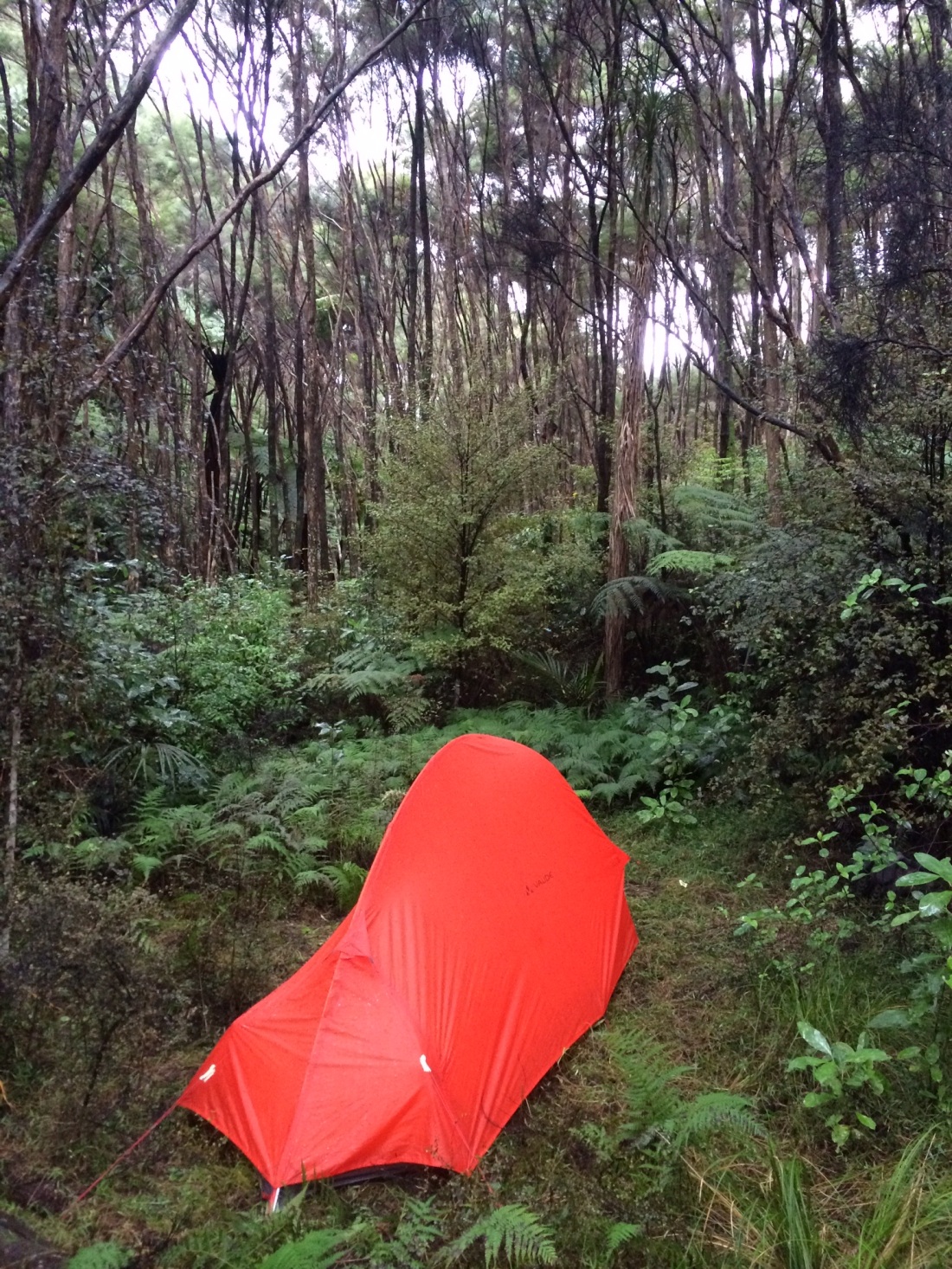
About 10km from the road there’s a creek, and the map said there was no more water for a good while, so I decided to camp – 18km would do for today. Just then fat drops of summer rain began to plop around me, and soon it was a deluge.
At this point not having a proper tent began to seem a mistake; for pack-weight reasons, I’d only brought a bivvy-bag. They keep you dry (supposedly) in your sleeping bag, but have no room for relaxing out of the rain, getting changed, sitting up, cooking food in the open tent door, or anything other than sleeping.
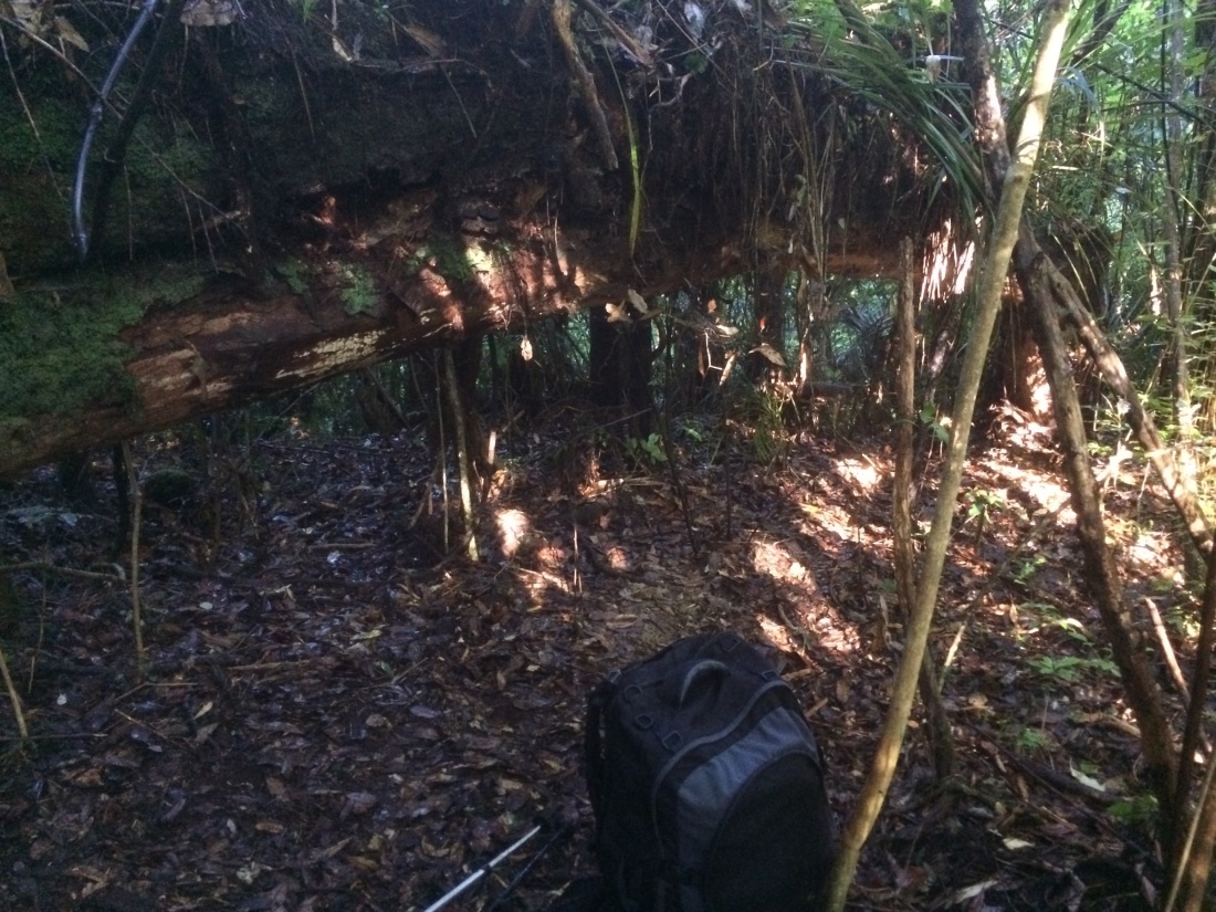
But I soon found a partly-propped up fallen tree which offered rough shelter. I set up my sleeping gear, then sat under the thick, horizontal trunk. I cooked my noodles and biltong, read Murakami for a bit, and watched the sheets of rain-water slide and tumble forcefully over everything.
A fallen log made my bivvy-bag a bit more habitable in the Herekino forest. This is the morning after, when the deluge had stopped and I’d packed up my sodden gear.
In the middle of the night, in deep, teeming darkness, I woke up gasping, with a savage headache. I realised I was not far off suffocating; my bag had a design fault meaning you had to leave it partly unzipped, or run out of air. But when it was unzipped, drops rattled on my face, and water pooled under my sleeping bag.
There was no way around it – I was wet, but it was a mild night. I would just have to try to get through it, and hopefully dry out in the morning. I checked that my phone, book and other valuables were in sealed ziplock bags; slurped some water and drifted back off.
Day 6: End of Herekino Forest to start of Raetea forest – 17.5km
In the morning, the rain had stopped but everything squished – my clothes, boots, sleeping bag, pack. It would be an uncomfortable start, but I’d sealed up food and a few other things that had to stay dry, so it was no real problem. I munched crackers and nutella and watched the bush steam in the early sun.
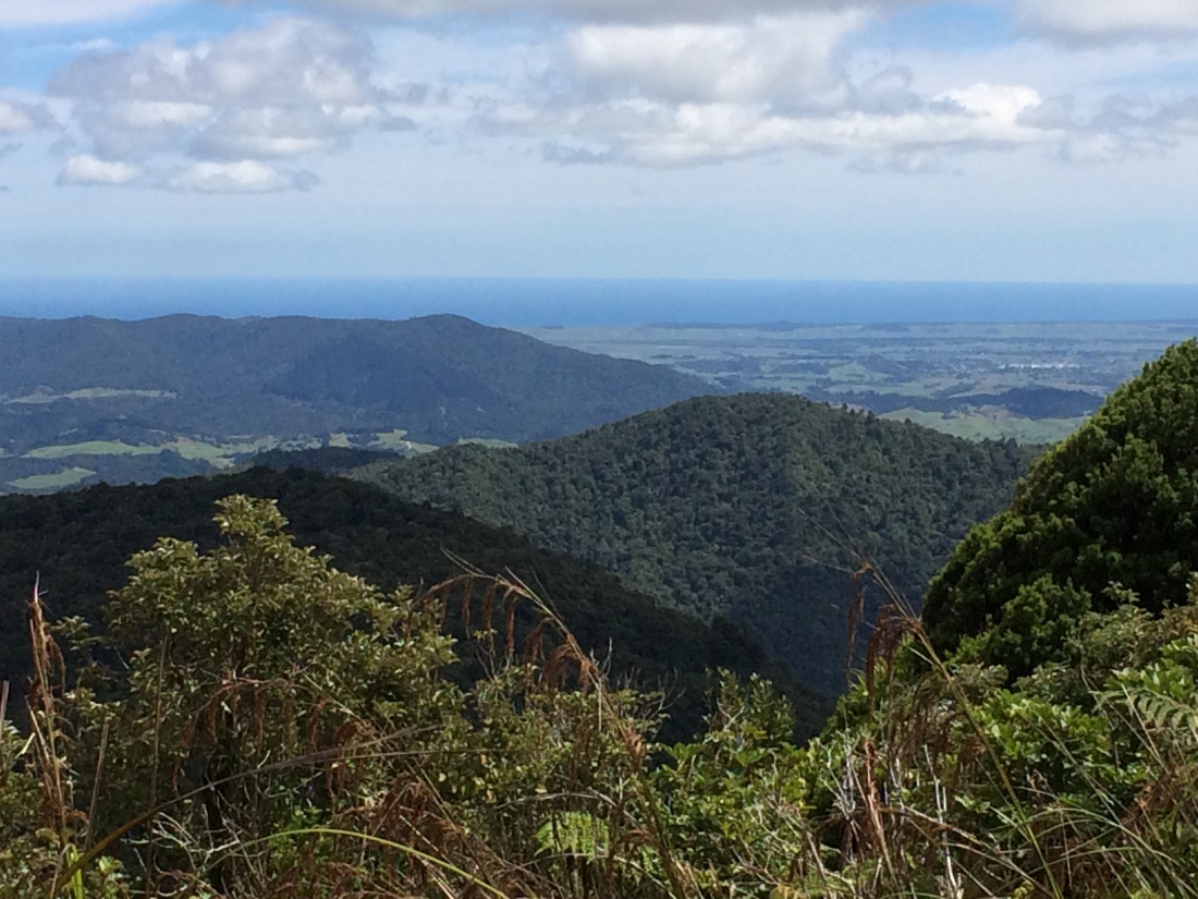
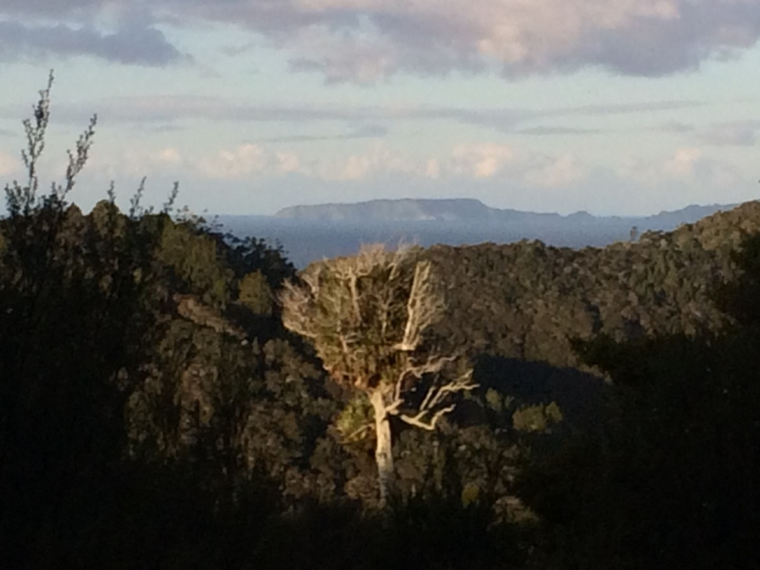
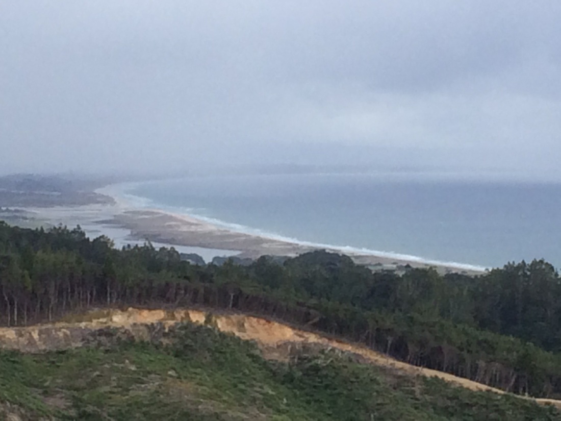
The track ramped immediately up the side of the first real peak of Te Araroa: Taumatamahoe. There’s views of Ninety Mile Beach – so satisfying, to look back and see all the ground you’ve covered on your own two, stumpy, little, hobbit legs:
Pretty sure this is looking down toward Ahipara and Ninety Mile Beach from Taumatamahoe peak, in the Herekino forest. I took a lot of snaps up there, all featuring variations on green hills and blue sea…
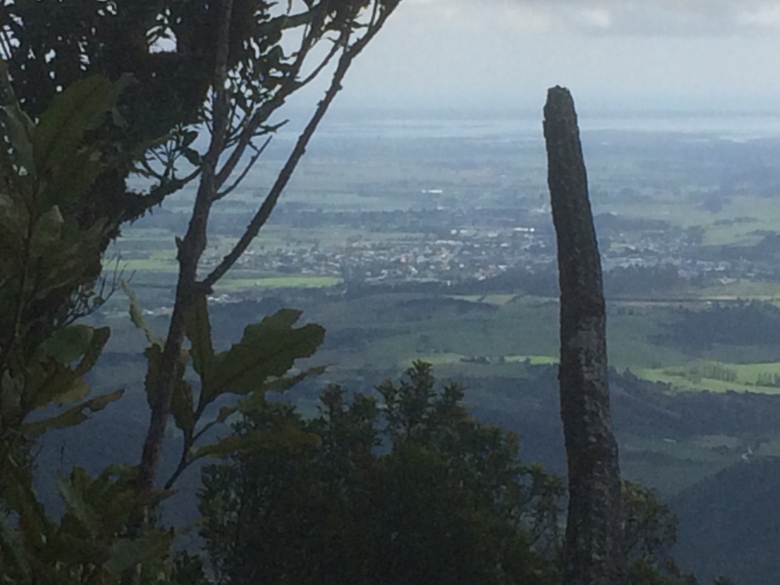
There were also glimpses of Kaitaia, and the peninsula narrowing off north, toward Rēinga:
Kaitaia, from the Herekino forest
Once over Taumatamahoe you slip and slide down a steep, muddy, rooty track, and soon pop out onto farmland. There’s a hut right beside the track an enterprising farmer has put up for trampers; the Te Araroa track notes have the details. Had I known how close it was I probably would have pushed on to it last night.
Then you’re onto sinuous, back-country gravel roads for a while. I grew to enjoy these on Te Araroa; for a start they remind me of where I grew up, way out the back of Dannevirke. Secondly they’re generally lined with lovely bush, or farmland; and finally you often meet cool locals on or around them.
Around lunchtime I reached a locked gate into a forestry block; the Te Araroa trust has negotiated permission to send the route across it, via private logging roads.
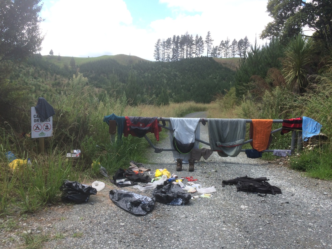
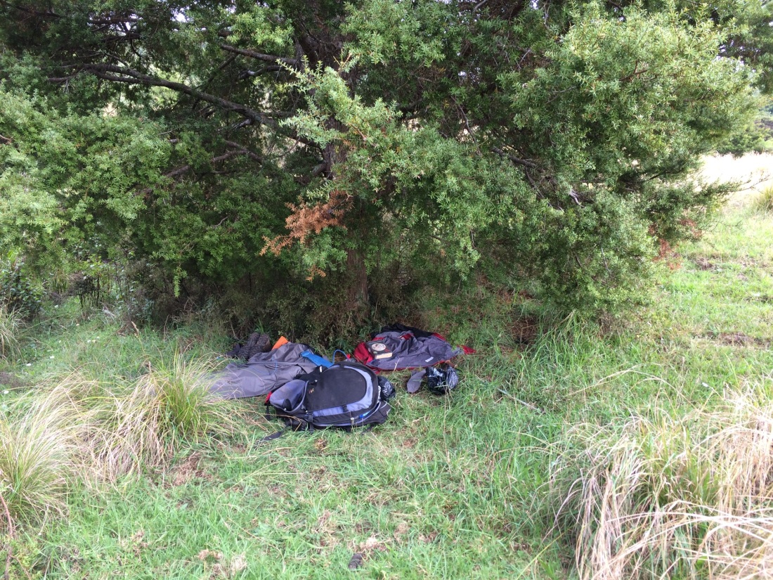
I hung all my gear on the gate in the hot sun, sat in the rays with my shirt off, boiled the billy and had a delicious, peaceful lunch and coffee.
This bush laundry pic shows all my kit for a 7-day, 160km walk – probably weighed about 10kg, excluding food and water. Note high-tech dry bags (rubbish bags from Pak n Save)
Past the gate and down the hill, I was kneeling to fill my Camel-Bak in the stream, my mind a million miles away, when a voice startled the plaque out of me. It was a German tramper, doing a bit of Te Araroa in the opposite direction. We had a nice chat, mainly about our water purification strategies; I use tablets, he a kind of filter you attach to your bottle and drink through.
He was loving the walk, he said, but wasn’t sure about the roads and forestry blocks: “I did not anticipate this.” Also he had thought there would be a shop at the trail head, near Kerikeri, so had hitched out to it with no food: “There would be a store there, in Germany.”
Luckily, some generous trampers shared their supplies with him; then after the first forest (which will be my third) the kind lady at the Mangamuka dairy let him tick up a burger, milkshake and more supplies. “She said I can transfer her the money when I get internet,” he said, smiling in wonder. “She was so trusting. You gonna love that dairy.”
“Yeah, I’ve read about it,” I said. The Mangamuka dairy is one of many little businesses along the trail that have become legendary among walkers, for kindnesses big and small.
We parted ways and I strolled on in the sun. I didn’t mind the forestry block.
Exotic forest seen from native bush, somewhere between Ahipara and Mangamuka.
Sure, there’s sometimes timber carnage all around – stripped, smashed trunks like naked limbs, piles of jumbled needly twiggy rubbish, scarred dirt in great bald mounds. But you’re generally still surrounded by trees, hills, clean air and silence; and you’re still picking your way peacefully over the flanks, curves and ribs of the Earth.
Another long gravel road section follows.
I like quiet, bush-lined back-country roads.
The highlight of this bit for me was a seemingly abandoned farm, with a sturdy old farmhouse, wool-shed, yards, fences and paddocks; all of it gradually succumbing to the exuberant bush. At the top of it, the homestead commanded a superb outlook down towards the Hokianga. All that dreaming, scheming and working, and now no-one was sitting with their feet up on the veranda rail in the afternoon sun to enjoy the view.
After the small settlement of Takahue I just had a late afternoon schlepp for a few kilometres up the gravel road alongside the Takahue River; when the road crossed the river to enter the Raetea Forest, that’s where I’d camp. But first, two experiences of Takahue hospitality.
A car barrelled past, raising a dusty cloud, then braked and reversed; I stood by, surprised, as the back window was lowered. A young guy held out a cold beer: “Here you go mate. We couldn’t just drive by and watch you walk along in this heat.”
Soon after, a car going the opposite way did the same manoeuvre. When it drew back level with me, a frantic, busy, electric face thrust itself out the driver’s window. It was another young man, this one alone, and with some kind of unique way of being in the world.
“Listen. On April 1, the clocks go back an hour. One, hour, OK? You have to change, change, just do it, it’s daylight saving, that’s what it’s called. People don’t know. I mean people from other countries. They don’t, they don’t, they might miss their planes. One, hour, back, OK? In six weeks, OK? One hour. OK. Thought you should know.”
I eventually convinced him I would change my clocks, and he nodded, gave me one more hard, urgent look, dropped his clutch and blasted off.
It was getting late when the Takahue Saddle Road entered fragrant bush. I found a quiet place beside the creek, set up my bag, had a swim.
The noodles were especially delicious with the cold beer.
Day seven: Raetea forest. 17.5kms
After breakfast in my hollow, I filled up my bottles, knowing this would be the last water until evening. The whole day would be along a bush-covered ridgeline, where creeks don’t flow.
The Takahue Saddle Road soon peters out into an increasingly rough four-wheel-drive track, then foot-track. It used to go all the way over the Raetea range from Takahue to a settlement called Broadwood; but rampant bush, time, and weather have cut them off.
On the way up there’s some kind of monastery or retreat; colourful prayer flags flutter.
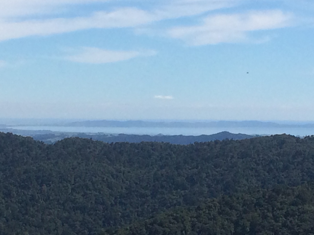
At the top there’s a saddle, from which what’s left of the old road drops down toward Broadwood. To the south there are views towards the Hokianga harbour, and to the north the early-morning mist filled a bay:
Rataea forest gets a hammering from trampers in on-line forums for being an extremely long, tough and muddy day, and that’s a pretty accurate summary. It has to be long, because of the lack of water; you’d be mad to carry a night’s worth of water all the way up there. So you have to keep slogging.
And it is a slog, because of the ridge’s serrated profile. You’re constantly climbing little peaks, then dropping quite steeply down – which can be just as hard on your legs with a heavy pack – only to have to struggle up another sharp climb. You’re almost never just bowling along a nice flat.
Also, it’s a proper tramping track – not benched, gravelled, or stepped, nor always well cleared of foliage; you’ve only got the footpad of previous walkers to go by, and occasionally not even that.
And it is definitely muddy, although I think I got off pretty lightly, with only a day of recent rain – after a wet week or two, it would be a bog.
On top of all that, because its higher than anywhere else in Northland, the ridge can be very windy and rainy (I was lucky enough to get a sunny, if muggy day).
Often, you wonder what the hell you’re putting yourself through it for.
But for all that, I revelled in it. You’re in seriously rugged, wild back country, with big mature bush all around, a long way from any road, house, or comfortable nicety of civilisation. It’s just you, your will, the mountains, and the trees.
To me, that’s proper tramping.
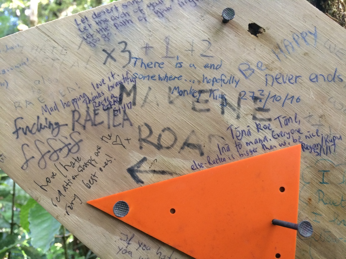
Graffiti on a couple of sign posts gave me the feeling some Te Araroa trampers get a bit of a shock to find themselves in such a brutal scramble:
“There is an end somewhere… hopefully,” wrote “Monkey King” (trail nicknames are a thing on long-distance hikes around the world).
“Fucking Raetea,” wrote a tramper with a less lyrical bent.
“I hate Raetea!” another fairly literal person said.
“Love/hate relationships are the very best ones!” responded someone.
But my favourite take was from Regan and Kupu:
“Tēnā koe Tāne, inā tō mana,” they wrote – a respectful greeting to Tāne, the god of the forests; then a phrase which I think means something like: how mighty you are (corrections welcome).
“Everyone else – Raetea is bigger than we are. Be nice.”
And as you battle on, on and on over the interminable peaks and troughs, there are plenty of moments of sheer beauty to keep you going:
A droplet of sun in the delicious darkness that is Raetea forest.
First you go over an unnamed 580m peak, then later, the 744m Raetea summit – the highest in Northland.
Up there, looking out over the dark, sunlit bush, I switched on my phone, and the whole trip changed.
There was a message from my Dad: his brother, my uncle, had died that last night.
I’d happened to wake up at 4am; I lay on my back in the crisp dark, looking up at millions of stars overhead.
Around that very moment, I now learned, my uncle had died – he’d been sick for a long while, and his faithful ticker had finally stopped.
I sat on that sun-drenched mountain top, looked across the island, and told my Dad how sorry I was for his loss.
“Me too, mate,” he said. “It’s the end of a long friendship.”
The view from the top of Raetea peak.
They gave me the funeral details and told me not to worry if I couldn’t make it – it would be a big trip back from the top of Raetea to a church in Dannevirke, and I only had a few days. I said I’d think about it, and let them know.
As I trekked along that endless ridge, I had plenty of time to digest the news, and decide what to do.
I’d been planning to get all the way through the third forest, Omahuta-Puketi, and another two days’ walk to Paihia, where I’d left my car; but that wouldn’t give me enough time to make the funeral.
I thought about my sporty, practical, strong-willed uncle, who lived a long, adventurous life featuring many travels and tramps.
How much he’d have loved this walk; and how much he’d probably appreciate me finding out about his death, and thinking over his life, in a place like this.
I thought about how much Dad would miss him: his only brother, his last surviving immediate relative.
I knew I had to be at the funeral. Te Araroa would wait.
I’d walk to the nearest road, which was soon after the end of the Raetea forest, and hitch back to Paihia, and drive home.
The track got rougher still as the afternoon lengthened; slowly I ground along. I got lost a while, when the track seemed to fade into the thick bush. Soon after, I gained a 638m summit, the sonorously-named Kumetewhiwhia.
The similarly musical, equally nasty Umaumakaroro (445m) tantalised me for an hour or two, before I finally dragged the bastard in and put it in my great, big, invisible bag of international peaks.
An excellent thing about summer tramping is daylight saving; the long, sultry evenings make it easier to finish long days like Raetea before nightfall.
The downside for someone of a dreamy disposition, like me, is you tend to think you’ve got plenty of time, there’s no rush; before you know it, it’s 9pm, and the night is closing in.
This happened just as I left the bush and emerged onto farmland. Now you might think it would be straightforward walking across open pasture; but Kiwi hill country farms are often rugged, slippery, lumpy affairs where the lie of the land is hard to read, and where passing stock have chopped up its surface.
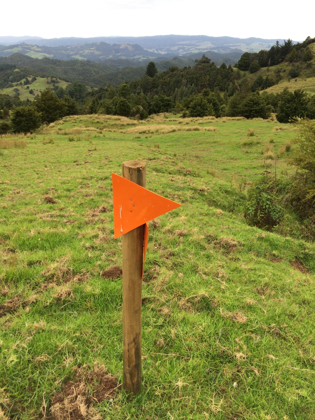
I was aiming to camp by a bush-lined creek beside the gravel road from the bottom of the hilly farm to State Highway 1. But as it got darker and darker I was having trouble seeing the orange markers, nailed occasionally to posts or trees.
Soon I was picking them up by torchlight; then I lost them completely.
Around this time I stopped for a bhuja-mix break. I was startled as I munched by what I’m pretty sure was a kiwi calling, in the bush that ran down to the edge of the ridge. A warbling gargle – something like the sound the old dial-up broadband – then a plaintive, rending “kiii-wiiii” cry, that raised my neck-hairs.
One of the last friendly orange markers I saw before night fell.
According to the GPS route on my cellphone, I was still on Te Araroa; but there were no more orange markers, and I seemed to be just lurching over open paddocks. I decided to keep going until I hit a creek which, my GPS, compass and paper maps said should be straight ahead. Then I’d have water, and could camp.
The creek was in a steep, bush-choked gully; I scrambled down to filled my bottles. I had a moment’s doubt whether the stream was clean enough, even with my purification tablets – it had passed through all that grazing land.
Then I saw two bright, unblinking eyes reflecting back my torchlight: it was a large koura, a freshwater crayfish, its body looking silvery and translucent, and its antennae sinuous in the current. If that pool was clean enough for a shiny koura, it was good enough for me.
Where the farmland met the gully I found a flat spot under a mature totara. It had been a long, hard, and emotional day. I ate my noodles, drank my liquorice tea and drifted off to the sound of possums chattering, and the creek trickling.
My last campsite on my first leg of Te Araroa, the morning after.
Day 8 – about 8km, bottom of Raetea forest to Mangamuka dairy.
In the morning I had a wash in the creek and found my way down to the gravel road. Then it was a 6.5km schlepp along State Highway 1’s hard tar seal, with my thumb out.
No-one stopped, but that was good because I got to see the Mangamuka valley on foot, which is the best way, with its marae, school, church, farm houses and signs in te reo Māori:
All dogs can kill Kiwi. Where’s your dog?
It also meant I got to finish this leg of Te Araroa at the famous Mangamuka Dairy. I could celebrate 161kms with a huge burger and milkshake; and it would be a perfect place to start again next time.
There’s a junction just after the dairy, so I had more traffic when I started hitching again; a shirtless forestry worker in a ute soon stopped.
A beer in one hand, elbow out the window, he told me he’d done a morning’s work near the Hokianga and was going home to Kaikohe. He was only going to take me to the turnoff for Paihia, but when he heard why I was heading home, he went an hour out of his way to drop me all the way back to my car.
He waved away my thanks: “You’ve got to be there for your old man, bro. And your uncle.”
In Paihia, my car was waiting patiently. I had a swim, then drove back south to say goodbye to Uncle Mike.
The next time I found myself back on Te Araroa, July 2017, winter had come – inasmuch as it ever comes to the gentle north.
This time I had a companion for the first week or so; she was stoked to be having her first taste of Te Araroa.
We left my car in Waipu and my old friend Nick dropped us at the dairy I’d reached last time.
Day 9 – Mangamuka dairy to Apple Dam campsite: 12km.
To get into the Omahuta-Puketi forest you have to walk up some gravel roads.
Now, some Te Araroa walkers organise rides for these connecting road sections, which do crop up fairly often; and Nick did offer. But I’m determined to walk every step of Aotearoa, even if I’m 100 when I shamble into Bluff.
And it was a nice way to start this stint. Omahuta-Puketi is pretty demanding, as it takes two full days to get through, and there’s a long section of creek-wading that’s too dangerous to attempt after recent rain.
So it was good to begin with a gentle saunter along sunny gravel roads through farmland and regenerating bush.
By early afternoon we’d dropped down into a sheltered spot known as Apple Dam campsite. We put up our tent and made the acquaintance of a chorus of native birds – kereru, tui, bellbirds and this guy.
A white-chested miromiro or tomtit kept popping up to keep us company.
Day 10 – Apple Dam to Pukatea Ridge Track. 12 km.
In the morning we followed four-wheel-drive tracks to a a long, grassy ridge, which took us down into a long canyon formed by the Mangapukahukahu stream.
The weather had been pretty clear, so on we strode.
It’s delightful to splosh along from pool to pool, the thick, cool bush all-enveloping on every side, unspoiled even by a track, nor markers.
It’s usually around ankle to knee deep, and occasionally up to thighs or waist.
After a few kilometres we reached a junction with the deeper, swifter Waipapa River, and stopped for lunch on the warm, grey river stones.
Then a track takes you on a scrambly, muddy sideways sidle along the Waipapa’s steep bank to the foot of the Pukatea Ridge.
The trail notes ask trampers to try to avoid camping anywhere in the forest except Apple Dam; but that would have made today a rugged, 25-kilometre epic, which was beyond us.
Now that it was winter there were only 10 hours or so of daylight, and it was getting dark already.
So we camped there, in a silent, stately grove beside the Waipapa. I had a fantastic evening dip in the very clean, very chilly river while my trail buddy giggled at my frozen shrieks.
Day 11 – Pukatea Ridge Track to Puketi Rd-Waiare Rd junction. About 18km.
We were both fairly creaky in the morning. One of the drawbacks of section-hiking a long-distance trail, is that every time you start a new section, you have to get trail-fit again.
And sleeping on a thin mat on a forest floor in winter makes your creakier.
But we downed coffee and peanut butter, and ploughed on up the narrow ridge through the high, sighing, silvery trees.
On the way up we found the skeleton of a large tree, just a dead, rotting trunk; it had been killed, completely suffocated by two huge creepers-turned-trunks, that had grown up around it, creating a living exo-skeleton for a dead host.
In the sap-filled bark of one of the blended stranglers, someone had carved a single, redolent word:
At the top of the ridge we came out onto Pirau Ridge Road; we bowled along in the balmy winter day for 9km, talking about everything under the sun and meeting the occasional cyclist or hunter.
Finally we reached the Puketi Forest Headquarters, where there’s a DOC campsite and hut. It was only mid-afternoon, so we filled up with water and pressed on; we hoped to get to a secluded spot to camp further down toward Kerikeri.
The route over farmland towards that spot was closed for lambing; we’d have to take a detour via gravel roads.
We went as far as daylight allowed and put up our tent on the grassy roadside. We ate, had a hot drink, and crawled into our sleeping bags as rain began to pour.
Day 12 – Puketi Rd-Waiare Rd junction to Kerikeri. About 20km.
A long, rainy day of road-slogging awaited. It was gravel, which is easier on your joints and feet than tar-seal; but it’s still punishing, and can be a bit boring – especially in the rain.
But it’s all part of the journey, and we still had plenty to yak about, and on we trekked.
Finally the Puketotara Road joins the main road into Kerikeri. Then a lovely undulating trail leads you off that, along the Kerikeri river, past houses and farmland and finally through luxuriant native bush to the full-throated Rainbow Falls:
We’d reached the Bay of Islands: one of the country’s biggest tourist draw-cards, as well as a historical touchstone. It was the site of some of the first sustained interactions between Māori and Pākehā, especially missionaries.
It was here the Treaty of Waitangi, the country’s foundational document, was signed.
Appropriately enough, we booked a room at the Hone Heke Hostel in Kerikeri’s town centre. Heke is arguably the emblematic Bay of Islands character, a thoughtful man of action, shaken out of his missionary education by his frustration with Pākehā encroachment on Māori land, self-determination and freedom. He responded by repeatedly chopping down the main local flagpole, no matter how they tried to defend it, because it flaunted the “Butcher’s Apron”: the Union Jack.
He got hunted for it, but it was a beautifully simple, eloquent piece of direct action which still resonates loudly down the years.
After checking in to the Hone Heke we went out for beer and burgers, joyfully devouring them like starving trail-beasts.
Our tent, sleeping bags, clothes and everything was pretty wet, but dried off overnight in front of the hostel’s log fire.
Day 13 – Kerikeri to Paihia: 23km.
As we pushed on toward Paihia in the morning, a thunderstorm rolled through and we got briefly pelted with heavy hail stones. But soon it cleared, and then we were under the protective canopy of a pine forest.
A carpet of rust-coloured needles muffled the forestry road that drew us slowly up and over the ridge between the towns; occasionally there was a flash of blue from the bay below.
We didn’t actually find it, but up here somewhere there’s a stone marking the opening of the first section of Te Araroa track, in 2014. We were too tired right then for a detour, but I would have liked to have seen it, because it involves poetry.
The trail notes say it has these lovely lines on it, from the great A.R.D. Fairburn’s poem, “To a Friend in the Wilderness”:
I could be happy, in blue and fortunate weather, Roaming the country between you and the sun.
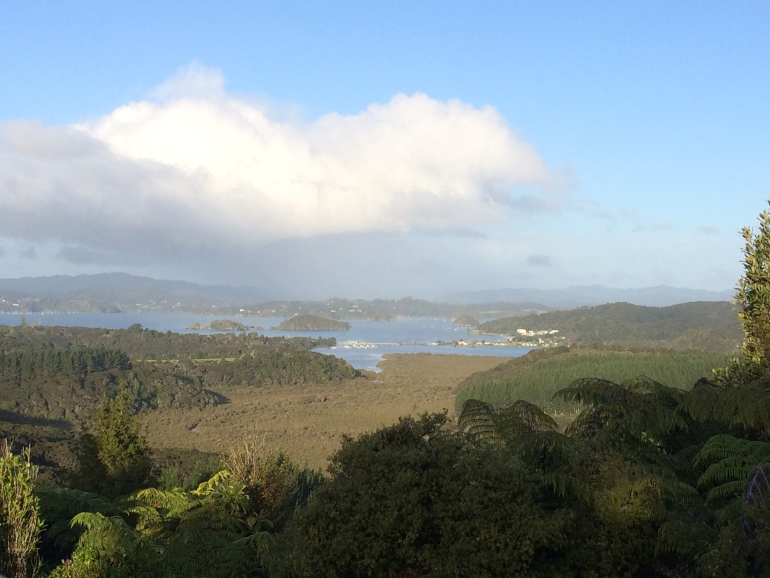
We came out in the afternoon to a golden view – here it was at last, the actual bay of the Bay of Islands:
Waitangi and Paihia from Mt Bledisloe.
Then the trail led us down to Waitangi, which in my opinion is the most important place in Aotearoa/New Zealand.
Te Araroa goes right by the Treaty Grounds where, every year, this country celebrates being formed not through a brutal war of independence, nor through a violent genocide, but through a dialogue, and a document – albeit an imperfect document, and at times a dishonoured one.
(And not to say there wasn’t violence and brutality, both before and after the Treaty was signed, particularly from the colonisers; Te Araroa takes walkers right past some of its bloodiest sites, as I’ll blog about later).
It’s a difficult document, the Treaty of partnership between Māori and Pākehā signed in1840. It forces us, if we take it with any kind of seriousness, to ask ourselves uncomfortable questions, not just on Waiting Day but every day – that’s if we want to be a decent, grown-up community. But I reckon that’s part of what makes a unique document, and a potentially powerful one, and one worth celebrating.
That’s what was on my mind as we marched along past the Treaty grounds in the dark of the midwinter evening, towards the lights of Paihia.
Soon you cross a bridge, and then you’ve got the long white waves on the sandy beach for company as you plod into town.
We booked into the YHA and headed out, ravenous again, for pizzas and beer. We ate and drank on a wooden platform under a pōhutukawa, overlooking the soft-sighing surf and the lights of the yachts as they lay quiet on the dark harbour.
Munching, we saw a large man with a box of Double Browns under his arm lurch towards us. Here we go, we thought. But all he said was: “Aha, very good, hello, hello. How’s it all going here, then?”
We said it was all going very fine, thank you, and he nodded slowly, contentedly, surveying us and beaming. Then he turned away with a gentle lurch to wait for his friend, who was emerging from a bush and jogging to catch up, buttoning his fly; somewhat awkwardly, given he also carried a box of “dough-bros”.
As they walked away we heard the first bloke, big, bluff and amused by life, resume the conversation the other’s piss in the bushes had presumably interrupted: “So. Tell me everything I need to know about your sister.”
Day 14 – Paihia to Russell Forest, 23km.
In the morning we had a well-earned sleep-in; we were kayaking the next bit, and the tides called for a midday start.
We resupplied at the Paihia supermarket, and took the ferry over to Russell – where Heke chopped his way into legend – to get a gas cylinder for my camping stove from Hammer Hardware.
Then we went down to the Paihia beach with our packs to meet Dan from Bay Beach Hire. This firm have an agreement to rent sea kayaks to Te Araroa trampers for the stretch down the Waikare inlet, saving us a long road slog.
They take your pack down to the end of the inlet, close to an hour’s drive away, and swap it for the kayak.
From memory it cost about $100, which I thought was pretty good value.
We climbed aboard our red tandem kayak and headed out into the beautiful bay.
You get a sea-level view of some amazing baches, some palatial, some quaint and rustic; also thousands of yachts, and secluded islands.
We had a picnic lunch on a beach on the way, and a cruise through some mangroves; watched the sinking sun make the water gleam.
Dan keeps in contact with you via cell phone; and when you pass a certain point he sets off to pick you up.
Waikare is isolated, almost otherworldly in its remote stillness. There’s a muddy boat ramp beside a cattle yards; and a gravel road disappearing into steep, bushy hills.
It was the end of the road for my lovely companion. She was going back to Paihia with Dan and the kayaks, and then back to Wellington in the morning. I had more time off, and was carrying on for another two weeks.
It was strange and a little sad to find myself suddenly alone as the car disappeared into the silent dusk.
There was nothing else to do, though, but step off up the darkening road.
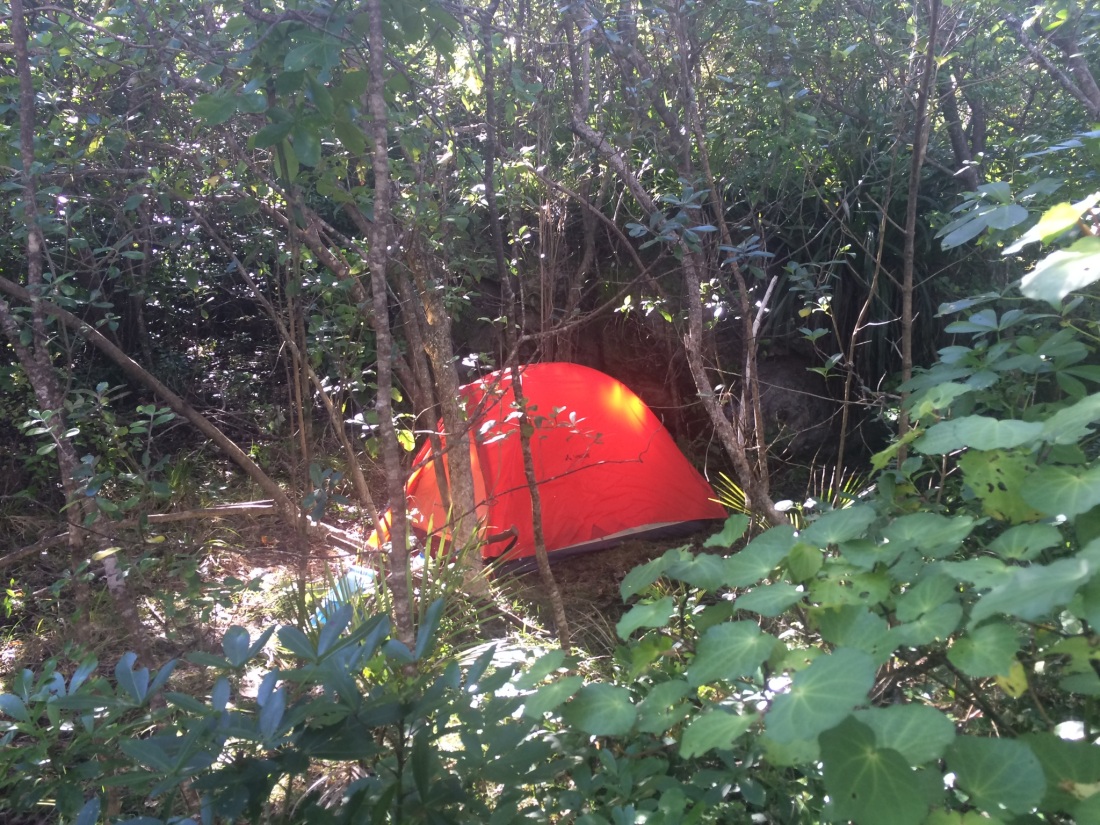
Where the gravel ends there’s a ford over a river; I went another k or so on the deteriorating track, then found a flat spot in a grove of ponga trees, and set up my little tent.
We’d done 100km in six days. Russell Forest breathed around me.
Days off on the trail are part of the joy of it. After constant movement, you cherish being stationary.
After 6 days and 100kms, I was due a day off. But my Russell Forest campsite was right beside a more-or-less road.
To be fair, most of the cars along the upper Waikare Valley Road aren’t going anywhere; it’s a car graveyard.
Old, newish, unclassifiable, they’re strewn in the bush and on the grassy verges beside the track by the dozen. Who knows why. (Why not, I guess.)
In their various states of rust and brokenness, they create that haunting feel of dead dreams; of nature snickering human ambition into silence. Like the loggers’ huts in the Herekino forest, or the Bridge to Nowhere on the Whanganui River, or hill country farms everywhere, sloughing off their topsoil into the sea.
It’s poignant, but not very restful. So I hauled my bones out of my cocoon, and packed it all up. Again.
Day 15 – Papakauri Stream track to Russell Forest Walkway bush campsite: about 5km.
The Upper Waikare Valley Road becomes the Papkauri track, which is a surveyed road through Māori land blocks. These are remote, private, ancestral lands; you’re here by unique invitation.
Access to them was only granted after the Te Araroa trust took the time to sit down with the locals, to explain their idea for a really long hikoi: a Māori word for a long walk, often with special meaning – protest, spiritual growth, discovery.
(It’s also a word which looks pleasingly like “hike”.)
After those conversations, the tangata whenua (people of the land; those who belong by ancestry to a territory) agreed to get on board. (Note: I’ll try to explain Māori words for international readers, in case I should have that joy).
A lot of listening has gone into building this long pathway. When you walk it, part of the experience is knowing you’re tracing a series of encounters.
Another reason I wanted to crack on is that the day’s 5km jaunt is not possible after rain – it’s through another of those lovely, forbidding river canyons. And rain was coming.
Five kms doesn’t sound much, but a) I was knackered and b) it’s a pretty demanding five. I spent the morning alternately scrambling over rocky, tangled banks to avoid pools too deep to wade, then sploshing through the ones I could.
I lost the track a couple of times; did some bush-bashing; it rained a bit. I felt flat. But it was still the wilderness, with me in it. And me, with wilderness in.
At the beginning there are some half-overgrown houses or shelters.
The track seems to lead right up to one; the first sign of a house is a row of tin-roofed kennels. On first glimpse, I jumped a bit; they looked like the shadowed dens of dogs who snap first, sniff later.
Then I saw the chains, ending in nothing: just a grassy space where ghost-dogs twitched.
Their water bowls also held nothing, only cracks and blackened leaves.
In places along the track there are strong fences threaded through the bush, some electrified; you can see flashes of pasture here and there. Someone is still wrestling income from this tough land.
Eventually you come out at a clearing, with a graffitied shelter; the Russell Forest Walkway passes alongside it, and you take it. You ford the Papakauri stream one last time, then switchback up a ridge.
I scanned the bush for somewhere flat to camp; I needed to stay close to the stream, for drinking water. But the land falls drops away on one side, and climbs hard on the other.
Eventually I saw the afternoon sky gleam through thinning bush above me; did it suggest a flattening? I dropped my pack by the track and struggled up the cliff above on rungs of saplings and weeds. Gradually the slope lessened, then stopped for a few metres, and I’d found my home for the next 36 hours – Chateau Papakauri:
I stocked up with water, hauled my pack up and made my dinner; watched the sun set through slender trees. Then I chilled with Murakami, some bourbon I’d been saving, some very dark chocolate, and a nice Monte Cristo habanero my friend Trish gave me.
Billionaires would not savour finer evenings.
Day 16 – Chateau Papakauri. Rest day: 0 kms.
I ate, lazed, read, snoozed, and swam. Later I wrote in my journal, did some trip planning with GPS and maps, and watched the changing shades of green.
It was a great agenda.
Day 17 – Chateau Papakauri to Helena Bay: 17kms.
With a new jauntiness to my lumber, I lumbered off.
The walkway is wide, even drivable, so progress is quick to a road-end. Two notable things along it were:
1) Signs that start appearing, warning in a ferocious font that the land beyond is strictly PRIVATE, there is to be strictly NO hunting nor camping on it, and that ALL dogs will be strictly SHOT.
(This was a lot further along than where I camped – Chateau Papakauri was not in dog-shooting country).
2) The reappearance of the Pacific, in bursts of a certain blue through the trees.
As I walked out onto the gravel road-end a white, powerful, lowered car throbbed out of a grassy driveway.
A sleepy woman in a dressing gown, steaming mug in her hand, leaned by the back door watching it go.
All around was a bayou-type landscape; swampy pools of mangrove-laden water, drowned fences. The gravel road out of the bush went straight down through it on a kind of causeway, at right angles to the main road between Russell and Whangarei.
The low, throbbing car eased itself very slowly off the grass verge up onto the road; it cleared the bigger stones by millimetres. Then it ground very slowly down the corrugations; it barely seemed to go faster than me, poling along in its wake.
Reaching the junction with the main road, it nosed gingerly out onto the seal. There was a tiny pause; then it exploded away toward civilisation.
Now came my first real tar-seal-slog on Te Araroa; up until now I’d only really put in significant distances on gravel, which is kinder.
North Island tar seal roads, the New Zealand Transport Agency website says, are mostly made of sharp-edged chips of andesite and basalt – volcanic rocks chosen for their density and hardness. They are pressed into bitumen to form an inscrutable carpet.
These chips are every bit as ruthless as the NZTA hopes; they must be some of the hardest, densest items in the universe. They’re like the infinitely dense, infinitely small remnants of a billion supergiant stars, duck-pressed through one black hole.
I’m saying, walking mile after mile on tar seal with a heavy pack is hard, and you must be dense to do it.
But sometimes you just have to suck it up, to get to the next bit of paradisiacal off-road walking.
You carry on. And then you come around a corner and see this:
Te Mimiha Bay, part of Helena Bay. Another shade of blue.
And it all seems worth it.
Gorgeous as it is, there’s no accomodation in Helena Bay, nor even anywhere you’re officially allowed to camp. The track notes mention a couple of B&B options and a campground back toward Russell forest, but I’d wanted to get a bit further.
I was admiring the diffident evening light on the water when a rumpled, kindly older man appeared with a rumpled, kindly-looking older dog. I asked whether anyone would mind much if I camped on the verge at the end of the road, beside the beach.
“You’re not supposed to,” he said, pointing to a “no camping” sign. “But there’s bugger-all chance anyone from the council is going to come down here, in the middle of winter, and tell you off.”
I thanked him and gave his lovely old pooch a pat. “So,” he said. “You’re doing the big walk, eh? We get them through here all the time. Bit late in the bloody year, isn’t it?”
We chatted a while.
“Look,” he said. “You don’t want to camp there by the road. Kids come up from Whangarei, get drunk, do burnouts. And you’ll cop the night wind; it can be a real bastard. Just camp on our lawn here.”
He waved at a huge, well-curated expanse of lush grass, on which stood a couple of caravans, a cluster of small cabins and a two decent-sized houses.
“This is my family’s land – my cousins and me. It’s sheltered by the dunes, there. Just make yourself at home.”
Perfect.
I was unrolling my tent when he appeared again. “Look, I’ve got a sleep-out. Why don’t you just kip there? Unless you want to spend another night in that,” He regarded my tiny tent with a dubious side-eye.
As I was unrolling my sleeping bag on the bed in the sleep out, he appeared again. “Look,” he began, by now familiarly. “What are you doing for dinner? Dried noodles or some fuckin’ thing, I s’pose, like all a’ them.”
I was, in fact, having noodles, or some fucking thing.
“Come in and have tea with me,” he said. “It’s nothing flash; meat and veg. It’s good hill-country mutton, though, off our own farm; we sold the farm, but I filled the freezer first.”
I thanked him, smiling.
“Nah nah, don’t worry about that. I’m Jock, by the way. Grab a hot shower on your way in to tea, if you like. Clean towels in the cupboard by the shower.”
The mutton tasted like the best parts of my childhood. Jock told me about his kids and their kids; how his family had slowly gained access to this piece of land.
“I’ve been coming here on holidays all my life,” he said. “I’m the fifth generation of my family to come here. We ended up getting title of this one acre, and we wouldn’t swap it for anything.
“It’s all Mah-ree land,” he added, mangling the word in the usual, older Pākehā farmer way.
But he had an unshowy, slightly grudging respect for the original owners of that land, which you could also possibly call typical of many older Pākehā farmers.
“We buried the kids’ placentas over there, under those young pōhutukawas,” he said.
Then mused: “I must be bloody turning Mah-ree.”
He showed me his “waste-disposal unit”: a mob of fat, sinuous eels in the creek by his house. He fed them food scraps, knew them by name.
The family had started camping there, years ago, by permission from the Māori owners. Now they had gotten use of their acre indefinitely, with some astute lawyering and mutual good faith. But the conditions included never developing it beyond small baches, nor selling it; it could only be passed down within Jock’s family.
He told me about some of the Te Araroa characters who’d stayed with him.
“There were these two hard-case shelias, they camped just over there.
“One was Scottish and the other, I can’t remember. Oh man, they were hard case.” He shook his head at how much they’d made him laugh.
“We had the big earthquake while they were here and the tsunami siren went in the middle of the night; I ran them up to the top of the hill til we could see there’d be no wave. Then they spent the night in the house with me.
“We saw the damage in the morning on the news, and when the Scottish one saw the all the bottles of wine smashed on the supermarket floors, she went…” – he put on a passable accent – “och, gawd, wha’ a waste! Gimme a feckin’ straw.”
His shoulders shook with laughter.
“I gave them a feed and drove them up the road a bit to carry on their walk. Anyway, later on I got a parcel in the mail, and they’d sent me some shortbread.” He grinned fondly.
“Oh well, it was nice to know they appreciated it.”
He went on. “And there’s just been a Chinese girl, not a week ago. She said her name was Ocean Chow – Ocean’s my trail name, she said. I said: I’ll remember the Chow part.” He winked and laughed.
“She had arms and legs like sticks – God knows how she was going to make it down through the central plateau, this time of year.
“And there was a Frenchman; he had a little wee pack, no bigger than that” – miming a very small bag.
“He walked up to us and said, where’s the nearest shop? I haven’t eaten in two days.
“And he’d done 50 ks that day, or some fuckin’ thing. He said he was running the trail, travelling light. I said, you’re travelling light, all right, boy, if you can’t even carry food.”
He shook his head again with silent laughter.
“Anyway we gave him a feed, and off he went.”
Later, we got onto his memories of the district he’d lived in all his life; his roots went deep there. (A road I would walk the next day carries his surname).
He told me of an influx of shaken, prematurely older men, now dead, coming back from the second world war.
“A lot of them, when they came back, they went to religion, or the bottle.
“They never talked about it. One of ’em, the only time he ever mentioned it, we were out shooting pheasants and he said, oh Jock, you’d have loved it on Crete, when the paratroops came down – there were so many of them, our only problem was we ran out of bullets to shoot the bastards.”
It turned out Jock had a house in Whangarei, and a wife, but he confessed he preferred to stay out here most of the time.
“My excuse is looking after the dog,” he winked. “We can’t have him in town.”
In the morning, he flatly refused to take any payment.
He had survived a heart attack, a cancer scare.
“I love this place,” he said. “I’d like to die here.”
I could not blame him at all:
Day 18 – Helena Bay to Morepork-Onekainga track: about 20kms.
The first ten kilometres are mostly through private land; beautiful bush blocks laced among farmland along a ridge with gorgeous sea views. If it wasn’t for Te Araroa, only the generous land-owners would ever see them.
There are big, mature native trees, and some much smaller ones, dense-packed:
At one point, I lost a lot of time trying to find the way forward on top of a windy, slippery, hill-country farm; the track disappeared off the GPS file on my phone, and the printed map I had as a back-up mysteriously didn’t indicate the route either.
I didn’t mind too much, with views like this:
For lunch I chose a sunny, leafy spot on a bushy ridge. These moments are some of the best on a long tramp – when you stop striving forward, and simply sit in some anonymous spot you could never have known otherwise.
It’s just you, the steaming tea and the fragrant, softly-breathing bush.
A short road section takes you down to the next bush block – the Morepork-Onekainga Track. The first part is DOC managed, then there is a stretch of private land.
I had planned to get through to Whananaki, the next town, but because of the time I’d lost on the tops it was getting too late. To keep going along the rough, faint track in the dark would have been to risk a turned ankle, or getting lost.
I camped by a clean stream in deep bush, and drifted off to the kiwis’ screechy, hoonish conversation.
Day 19 – Bush above Whananaki to Ngunguru: about 28kms
In the morning I made my way down to Whananaki; the track comes out on its estuary, and what the town claims is the longest footbridge in the Southern Hemisphere.
It certainly isn’t short.
Before I crossed it, though, I walked down river, past the primary school, to the fish n’ chip shop, and had a tremendous greasy feed.
Then I plinked across that storied bridge.
Such lengthy plinking made me think, as touted hemispherical champions tend to do, of Bill Manhire’s “Poem For Vanessa”:
The longest poem in the Southern Hemisphere Alas, is not for every eye
Subsequent sections Shall go directly to Vanessa, by and by
Apart from its terrifically long bridge, Whananaki’s other claim to fame is being what media love to call a “bolt hole” for a certain politician.
The indestructible Winston Peters is from Whananaki, and still returns to his bach there when things get too hot in the capital, or when he wants to go fishing, or just to be mysterious. Te Araroa goes right by this legendary bolt hole.
Further on it passes a monument to a famous shipwreck, the Captaine Bougainville, and many more shades of blue.
It rained heavily that afternoon, on and off; but that just made the blues broaden their range even further.
You pass beautiful Sandy Bay, and Woolley’s Bay, both studded with mansions; and eventually emerge in quiet, peaceful Matapouri.
Here Te Araroa is supposed to head off into another, doubtless lovely bush block; but it was closed for trapping or track-building or something. So I carried on along the road, which runs roughly parallel with the closed track (but is probably a bit shorter).
Ngunguru, my destination, also has a wide estuary; but this one lacks a bridge. Te Araroa has thoughtfully arranged a ferryman, so you don’t have to swim, or do a huge road detour. I’d spoken to him by phone and arranged a pick-up that night.
My feet were aching and blistered, but on I trudged, through dripping bush under bright stars and a large, thoughtful moon.
I passed Tutukaka, playground of the rich with its elaborate marina, and eventually emerged into the little town of Ngunguru, on the north side of the estuary.
James Johnston runs Nikau Bay Camp and Cabins on the far side; he told me later he’d looked across the water as a boy and thought: what’s it like over there?
Now he hosts travellers on his own very tranquil, very pretty piece of “over there”; and he’s also the ferryman.
I’d asked him if I could cross by kayak. He said he usually just picked people up in his tinny and motored them across. “It’s only a couple of minutes – much easier than mucking around with a kayak late at night.”
I explained I’d decided not to cross any waterways on Te Araroa by mechanical means, including, eventually, Cook Strait. I want to do the whole length of the country under my own steam – even the watery bits.
Everyone puts their own little touch on this long walk, I’ve found; this is mine, Quixotic though it may be.
There was a silence on the phone.
I was walking as I talked with James; I plinked along one-handed in the dark, waiting.
Finally he spoke: “I respect what you’re trying to do. OK, I’ll tow a kayak over. See you at what, 9 o’clock?”
It ended up being after 10; I just couldn’t move my tired feet any faster. I texted him my progress, as I trudged through the wet hills. “Sweet as,” he texted back.
Finally I could see his torchlight bobbing by a jetty at a road-end. As I neared, I saw two women leaning on the balcony of a nearby bach, enjoying the salty night air. I looked up, plinking wearily along. “Kia ora,” I sang out.
“Kia ora,” they said, sounding pleased. “Oi, is your name Caleb?” “Yep,” I said. “Oh, there’s a fulla down there looking for you.” They’d heard him call out my name as I got near.
“Yeah I know.” I paused – James was waiting, but it seemed rude to just blast on by.
They eyed me; my reflective flouro leggings, my head torch, my poles and heavy pack.
“Are you a firefighter, or something?’
Surprised, I said I was – how did they know? “Oh, you just look like one.”
No-one had ever said that to me before. I was inordinately pleased. What a funny little conversation, I thought.
I kept walking, conscious of James waiting patiently in his tinny, and seeing I’d be within talking range of them for another hundred metres or so.
“Where have you come from, e hoa, and where are you going?”
I said I’d come from Rēinga, and was going to Bluff. “Oh, eh? Tu meke, bro! That’s amazing. Far! That’s choice!”
I smiled, embarrassed. One of the women went on: “What are you doing it for? Is it for something?”
People often want to know that, I’ve found – like, why the hell else would you be out here, struggling along in the cold like a wounded camel?
Nah, I said, it was just for the hell of it. “Oh, eh? That’s choice! We should tell the papers, get it on the news!”
She was obviously not a frequent visitor to Ngunguru, James told me later – the locals no longer find length-of-the-country trampers newsworthy. It was very touching.
I laughed, thanked them, called a goodbye. They leaned forward, started punching the air, clapping, cheering and even doing a kind of stadium chant after me:
“Yaaaaay! Go Caleb! Go Caleb the firefighter! Che-hoo! Ca-LEB, Ca-LEB!”
It was surreal, and sweet. I was smiling in the dark as I limped down to the jetty. “G’day,” James said, “friends of yours?” They are now, I said.
He took my pack, helped me aboard the kayak, handled me a paddle. “See ya on the other side – see where that light is, below that dark patch? I’ve got the fire going; you can warm up and tell me all about your trip.” He motored off.
Suddenly I had the sweet relief of being off my aching feet; and I was bobbing in the middle of a silent, empty estuary. I looked up: the Milky Way’s frozen, ghostly yell.
The surf boomed beyond the bar.
I stopped paddling a while, lay back on the back deck; gazed around me, drank it in. I had to laugh, it was so perfect.
On the other side James cooked sausages while I thawed by the fire; we shared beers I’d lugged from the Matapouri dairy. He told me of his vision to recreate at Nikau Bay the classic camping holidays he remembers from his childhood – wilderness, simplicity, community, freedom.
He wouldn’t let me camp. “Just crash in my spare room, mate.”
Day 20 – Nikau Bay to Taiharuru: 30kms.
In the morning he gave me coffee, and porridge with blueberries and cream.
James typifies what long-distance hikers call a “trail angel”; just like Jock at Helena Bay, and the lady at the Mangamuka dairy, and many more.
And this was the view over the estuary from his verandah:
Nikau Bay
From James’s the gravel road winds up into the hills.
One thing that makes me not mind Te Araroa’s infrequent road sections too much is the different perspective you get on roads, when walking ’em.
Normally you just smash them out, pushing your car through their curves and slopes as hard as you can, obliterating the distance to your destination as quickly as you and your machine can handle.
But when you’re walking, there’s none of that; you minutely experience every camber, sidestep the potholes, feel the changing texture of the road-metal, notice the chiselled depth of each ditch and culvert, appreciate the skill and persistence of the road-builders:
Still life during bhuja-break, with toetoe leaves, boots, gaiters and a beautifully engineered bit of rural road.
Eight kms from James’s house you come to the Mackerel Track, a scenic shortcut through a pine- and bush-filled valley, with a meandering stream.
Up the other side you wind down tar-seal bends through bush, then mangroves. I reached a bus shelter at the end of a long drive just as a heavy curtain of rain descended. I sat in there and brewed up for lunch; by the time I finished the sun was out.
I came to a woman on a quad bike; she asked me to wait as a mob of big, black cattle came roiling towards us. She blocked the road and they turned into the open gate; she rode in after them, standing on the foot-pegs, cow-woman style, hooting.
The road goes straight after a while, parallel with the beach; but, the track notes say, the land between road and sea is private, and there’s no public right-of-way. So you just have to trudge the tar seal, looking at the sunset over the shoulders of aloof, exclusive baches.
Finally I reached Pataua South, over another estuary bridge. There’s a B&B called Tidesong a bit further along, in another tiny settlement called Taiharuru. It’s mentioned in the trail notes, and it sounded good; I’d rung ahead and booked. The tide was right to do the last bit via a shortcut along the estuary edge.
It was getting dark, but I was keen. I didn’t want to walk on the road anymore. I rang to say I’d be there soon, and which way I was going, in case a taniwha got me. Ros, co-owner of the B&B, seemed dubious: “We can come and get you.”
But I wanted to get there myself, in the moonlight. I sploshed into the dark mud.
At this point – in a first for A Moonlit Tramp – I’ll blog the rest of that day, and the first part of the next, in verse:
The estuary at Taiharuru
Tidesong
Taiharuru, Northland. 17.8.17
Rosalind,
your strong voice finds me in the dark,
warm as honey-coloured timber,
where I stand on a winter beach
a mile or three through mud
and mangroves from your house.
Are you sure? It’s late and cold; Let us come and get you. You’ve walked most of it.
But my hungry feet want all of it,
every last stagger.
So by bone-bright stars,
by a chip of moon,
by splashing and swearing,
I slop through briny badlands,
a shelly, crunchy, rooty, silvery long-cut,
And I do reach the land you promised,
only to wander, exiled on gravel tracks,
below your B and B,
until you come and find me,
after all.
You and your Hugh
(to whom your many gifts
include a kidney),
smile welcome,
start me off on beer,
then prescribe a long shower
to hose off 30 clicks,
then feed me: roast meat, chocolate pud, other marvels –
it’s like you’ve read all
my tar-seal dreams.
Turns out you travelled this long path too,
years back; a way to mark
the saving grace you did for Hugh.
He drove a camper,
to cosset you at trail heads.
(You two had a lot to hug about.)
You walked alone among dark hills;
biked the odd bit.
Your brown eyes gleam,
when you relive
the day you clocked 90 k
from Whanganui.
I just kept going, and going, and going. I felt like a big boat, with the wind behind me.
Hugh listens, proud, retired, besotted.
I’m a bit in love too.
You say you’ll be up at dawn,
at low tide, though it’s a Sunday,
to cook me eggs,
and show me how to cross the estuary,
and where to carry on,
down the country.
I’m touched. Although: Praise the Lord, you’ve written on your lintel;
It clouds my moved heart,
because where I’m walking, in part,
is away from such decrees:
saviours, saints, shame, hell.
But in the morning, with the sun
burning orange above the channel,
and your calm back leading me
through mangroves,
I can’t hold it much against you.
Then you murmur, bend,
and from sucking mud pluck
a rough chunk, something
cob-sized, glowing,
a piece
of scuppered sun?
Kauri gum, you say, voice low, I’ve never seen such a huge bit.
Rubbed, the old sap shimmers,
strange jewel,
silent, heavy, resonant.
You’re hushed with pleasure.
I’d give it to you, but would you want the extra weight?
You mean it, and I half do want it,
despite my sullen shoulders.
But I can’t take such a treasure, when
it’s reached up like this to you.
And when the kindness of your hearth
merits every gem unearthed
from sand, roots, loss, tide.
Your surprised grin,
the gold sun, the river’s rise,
Your quick, strong hug –
I’ll take all that with me instead,
as I wade
across and out
of your shining world,
back into mine.
Crossing the estuary at Taiharuru, with Tidesong behind me. Photo by Ros Cole-Baker.
Day 21 – Taiharuru to Peach Cove: about 18kms.
After the estuary, I crossed a few paddocks; there are stiles over the fences.
Trampers cross hundreds of these purpose-built stiles on Te Araroa, where the trust has negotiated routes through farms; you get used to the rhythm – left step, right step, grab the orange-tipped wooden pole for balance, pull yourself up and over.
It always reminds me of how some of the more athletic sheep-dogs on our farm used to soar over fences. Hauling myself over the stile, I see them flying over barbed wire, front and back legs stretched, prone bodies riding air like canine Supermen, tongues lolling in happiness, eyes brightening toward the promise of the far paddock.
In one paddock, a mob of yearling cattle rush up and crowd around me; this also happens quite often on Te Araroa. They mean no harm; they just associate people with food, especially in winter. “Got any hay?” say their large, luminous eyes and colossal jostling bodies. “We bloody love hay.”
“Sorry, ladies,” I say. “No hay today. Only instant noodles. And I need those.”
Their stiff-legged, forlorn stares follow me, long after I’ve left the paddock and am disappearing down the road toward Kauri Mountain.
Kauri Mountain is actually a low, steep hill, but still commands views worthy of its grandiose name:
View from Kauri Mountain, looking south down Ocean Beach to Bream Head (Te Whara). Hen and Chickens Islands beyond.
There’s a short bush walk down the other side onto Ocean Beach, a lovely golden stretch about nine kms long.
At the far end is a hard, steep climb up to Te Whara (Bream Head). This is one of two main peaks that make up the Whangarei Heads. It has huge old rock chimneys on top, totemic in the evening light.
At the top are dazzling views in all directions. To the east, and south, the Hen and Chickens (Marotere) and other islands – I think that’s Little Barrier on the horizon:
To the North, you can see up past Ocean Beach to Taiharuru, Cape Brett, the headlands around Ngunguru:
The setting sun casts a darkish, cone-shaped reflection of Te Whara on the water of Bream Bay, next to the Hen and Chickens:
One of those totemic chimneys, looking west:
And to the north-west, Mt Aubrey and Marsden Point guard the entrance to Whangarei Harbour, lit up like brass bowl on a hot hearth:
I could have stayed there drinking in the splendour for hours, but I had to box on to beat the dark.
The track undulates along the spine of the range that guards the harbour; until finally you reach a junction where a steep cascade of steps drops straight down to the water, far below.
I’d been told there’s a thousand; I lost count, but it’s about that.
Peach Cove hut is a neat little DOC hut tucked into bush above the cove; it was occupied by a group of teenage fishers. I stopped for a chat; they gave me a can of Cody’s (an outstanding pre-mixed bourbon and coke, for the uninitiated). “Drink up bro,” they said, “we’ve got boxes of ’em.”
After the quite big kilometres I’d been hammering, that small can’s industrial quantities of sugar and caffeine seemed like nectar.
The hut was full, so I found a flat spot for my tent in the trees near the beach; I prefer to be under the stars, anyway.
I took my time finding the ideal place: secluded, yet in earshot of the sea. I was going to spend the next day resting, after six days straight on the trail.
I wanted stillness, which is what Peach Cove offers.
It’s probably only half an hour by boat from a huge oil refinery; but the only access, apart from boats, is those thousand steps, so it’s a pocket of peace.
It faces south, with its back to the refinery, the port, the roads and the city, staring out into empty ocean; and nothing gets refined there except jaded spirits.
Back against a boulder, I sat watching the night dye the sky a fitting shade of peach, then yet another blue, then black.
And, finally still after six days, I sat and did nothing; nothing but listen to the quietest of waves.
In the morning, after hiking well over 100kms, it was utterly delicious to be able to laze around, read a while, get up when I felt like it; and even more delicious to have breakfast like this:
Lying there in the sun, I sipped coffee, munched crackers with peanut butter, and felt the boulder under me shake as the big waves hit it.
Note the rugby socks and stylish windproof leggings from Warehouse – despite the “Winterless North” nickname, it got down to just below zero that night. I was fine in my tent, though I did wake up at one point just before dawn and put on my raincoat – it was the only thing I had left to bolster my sleeping bag.
The teen fishers went home after lunch and I had Peach Cove to myself. It’s a very peaceful spot, perfect for a rest day.
I liked my little sunlit glade.
Day 23 – Peach Cove to Mackenzie Bay: about 7km.
The thousand steps were a lot harder, of course, going back up; but the pain was lessened by the views down through bands of sun and shadow:
Looking south from the track from Peach Cove back up to the Whangarei Heads ridge-line.
I was aiming for Reotahi Bay, where I’d arranged to paddle a kayak across the harbour to Marsden Point the next day; but I fell about 5kms short – the views are just too distracting:
Smugglers Bay from Matariki (Mt Lion); Whangarei harbour entrance beyond
As always, some of the most beguiling vistas are back the way you’ve come. It’s so satisfying to see the huge sculpted immovable swathes of land, that you’ve picked your way obstinately over:
Kauri Mountain and Ocean Beach from Matariki (Mt Lion).
One of the most striking sights appears across a paddock of lilies and toetoe. It’s Mt Manaia, full of legends, history and mauri, with its brooding, taniwha-like, sculptural forms:
Mt Manaia
Finally I made it to Dougie’s place, Appin Cottage; it was a paltry 7kms, but the campsite overlooked the major international shipping lane I would be paddling in the morning.
Dougie is an artist and aficionado of Celtic lore, as well as a purveyor of hospitality to trampers; we sat up in front of his log fire with a Laphroig. Then I went to sleep in the bamboo grove, lulled, strange as it sounds, by the electric, brassy-bass hum of the refinery.
Day 24 – McKenzie Bay to Waipu (Tip Rd): about 21kms.
I’d arranged by phone to meet Peter, my kayak-contact, at 10am on Reotahi beach. Peter’s one of several boatmen listed in the Te Araroa trail notes who can ferry walkers across the 1.5km mouth of the Whangarei harbour for about $20. Otherwise you’d spend a day or more on a huge back-track north and east into Whangarei; crossing the mouth means you can carry straight on south.
But, as mentioned in an earlier post, my aim is to go the whole length of NZ under my own steam – so where water crossings are called for, I’ll kayak.
So I asked Peter if he’d mind just taking my pack across, while I paddled behind; he agreed with benign amusement.
My mate Nick from Waipu lent me his fishing kayak, and arranged to leave it on a pontoon at the Marsden Point marina, near his work. (It would have been a 2-hour return drive for him to drop if off on the Reotahi side, so that was out of the question).
I was on the beach at 10am; Peter had said to phone him when I got there. “Look up toward Mt Aubrey,” he said on the phone. I saw a figure on a balcony waving. “Come up for a cuppa.”
Peter works at the port over the water from his home at Reotahi; but he moonlights as a log-catcher. If a log falls into the harbour while being loaded, it quickly becomes a significant shipping hazard. “It’s only a narrow bit of water,” he said, “but the tidal currents are huge.”
A tonne or two of spear-like timber, just below the surface, can wreck anything. So the call goes to Peter, or a mate with whom he shares a 24/7 roster; he jumps in his boat and zooms after the errant, lethal log.
He snares it, and tows it back to be re-loaded.
In between that, and his regular job, he ferries across walkers. “There were hundreds last summer,” he said.
The crossing is notoriously treacherous, Peter told me. A lot of port or refinery workers commuted in tinnies or kayaks, and he’d had to rescue a few that had come to grief. “It’s a long drive around through Whangarei, so sometimes they try and shoot across, when they really shouldn’t.”
In his time there’d been a few lucky escapes, and some deaths.
He saw me looking nervous. “You’ll be right,” he grinned. “It’s a perfect morning for it.”
Mt Aubrey, Reotahi Bay boat ramp, and some remains of the old meat works.
After the tea we climbed aboard and launched; Peter threw in a speedy lap of nearby Motukaroro Island, where several seals lazed. The waters around it teem, he said; its a marine reserve.
Peter in his log-catching, tramper-ferrying boat.
The refinery loomed over the water beyond the island, droning its quiet industrial hymns to the indifferent sky.
We reached the pontoon using the map Nick had sketched for me; dumped my pack, grabbed the kayak, stowed it, and were off back to Reotahi.
Drawing up to the beach Peter dropped my lurid orange coracle overboard, helped me scramble down, and sent me off with a smile and a wave. Peter’s The Man.
Looking back I could see the ridge-line line I’d walked over Te Whara and Matariki, with Peach Cove on the other side; closer was the bulk of Mt Aubrey, with Reotahi village by the water:
In less than half an hour I was paddling up to the Marsden marina; I had a few minutes rest, watching my footprints dry and thinking travelling thoughts. Then Nick turned up with a hot pie. Nick is also The Man.
Nick dropped me at the Marsden Point beach, where the ferry would have dropped me had I not kayaked.
I wasn’t skimping any of the Te Araroa route, mind, because the distance I crossed is actually greater than the ferry route. (I’m a bit nerdy about not skimping.)
A little way down the beach you duck under the huge, gullet-like pipeline that takes the refinery’s products on and off the docked ships. Then you set off along the long, creamy crescent of crunchy shells and crisp sand that is Bream Bay.
I had 20 kms to go to get to Nick’s house in Waipu, where I’d stay that night; the crossing had used up a lot of time, so I had to get a wriggle on.
It was a good feeling to put my head down, put my legs in gear and charge off down the sand, a small human engine.
I stopped at one point, though, to phone ahead and arrange another river crossing.
10kms down the beach is the Ruakaka River; you can wade it at low tide, but I was going to be there when it was high.
The trip notes mention Simon, who can hire kayaks to trampers for the crossing.
When he met me at the mouth, I told him an idea I’d had on the way: instead of walking the 6kms down the beach from Ruakaka to the road into Waipu, could I rent the kayak for a bit longer?
Normally he wouldn’t, he said – if something went wrong, he’d be liable. But I told him I own a kayak, go out on Wellington harbour a lot, carried a personal locator beacon and phone, and am famously prudent; after a while he agreed.
And so it was I saved 6kms of shoe leather, and soaked up great views back up to the heads, and marinaded myself in wintry, pewter hues.
We arranged Simon would pick me up from Tip Road, where the trail leaves the beach and heads into Waipu. Soon I was paddling peacefully south, parallel to the breakers, past the Uretiti DOC campsite; it made a great change from foot-slogging.
This is how it looked on my GPS – the purple line of the Te Araroa route, the Ruakaka racecourse and river mouth at the top, Tip Rd into Waipu at the bottom, me under the blue, starry shadow of the satellite:
Simon was there as promised; I paid, he gave me back my pack, I gave him his kayak. Perfect. Simon is the also The Man.
Good old mate Nick was waiting for me there too, with Ruby the dog. After she had a go at the three-legged land-speed record on the beach, we were back at their house and into a frosty beer or seven.
Day 25 – Waipu (Tip Rd) to Cove Rd, near Bream Tail: 24km
Just after dawn, on his way to work, Nick dropped me back at the end of Tip Road. By late morning I was through Waipu, and up on the Brynderwyn Range, looking down over the sweep of Bream Bay toward Marsden Point:
Waipu River Mouth and Bream Bay from Cullen Rd, on the Brynderwyn Range.
In the evening, I made camp in a quiet patch of young manuka near Cove Rd. Their slender tops swayed with a composed, mesmerising grace in the easterly that built all night.
Day 26 – Bream Tail to Pacific Rd, south of Mangawhai Heads: 21 kms
This was my last day on the trail for that trip. I was aiming for 21 kms, which would give me a total for the trail of 461km, and 300km for this mid-winter stint.
It was still fairly sheltered as I set off from my campsite and then up Bream Tail Rd. But near the top of its gradual incline you are nearly overlooking the sea, and any weather coming off it – and today there was plenty. A storm wrecking roads and houses further south was more benign here in the balmy north, but the wind and horizontal rain still shrieked in my ears, threatened to tear my woollen hat off, and sent me staggering sideways at times.
The trail takes you through paddocks and then a section of mature bush, complete with some of those whale-like kauri, serenely unmoved in the face of the storm.
Then you pop out onto the Mangawhai Walkway, a clifftop track with fantastic views. One of the pleasures of a long tramp is the way the outlook suddenly, radically changes. It happens just as you feel as if you’ve been walking past a landscape for so long, it has seeped into you through your boots.
I’d spent the last four or five days looking at Bream Bay, the Hen and Chickens islands, and the Whangarei Heads, from just about every possible angle; but now I’d made my way over the Brynderwyn range, and a whole new tranche of terrain was thrown open:
Looking south toward the Mangawhai harbour-mouth and Te Arai Head from Mangawhai Walkway.
The Mangawhai harbour is too wide to wade and I doubted I’d get anyone to hire me a kayak on such a rough day; so there was nothing for it but to trek around through the townships of Mangawhai Heads and Mangawhai, and over several bridges. This adds about 5 kms, but is worth it for the outstanding burger shops you walk right past.
Finally you’re through the towns and back on a gravel road; it had rained on and off all day and the name of the road didn’t augur well: Black Swamp Rd. But soon enough I was in a sheltering pine forest, and on my last km or so of walking for this trip.
I found a sheltered campsite near the beach, but away from both the protected birds that nest in the dunes here and the fenced-off pines.
Freedom camping is a hot-button issue in NZ, but sometimes it has to be done on Te Araroa, because of the way the logistics of the trail unfold. I plan to avoid it, unless I’ll be in DOC estate, where you can generally camp where you like. But sometimes there’s no alternative: it’s getting late, there’s no traffic for hitching and no public transport to get to accomodation in town. But if there is no specific area set aside, it can feel like you’re going to get yelled at by someone, ordered to move on at 2am.
You just have to be a bit delicate about it, and sensible, and hope for the best. Of course you leave no trace when you pack up – you take your rubbish, dig a very discreet toilet pit if you have to, light no fires, etc.
In the morning the storm, and this section of my tramp, was over.
I went for a swim, had breakfast in the dunes, and spent the morning enjoying the glorious golden views up and down the beach.
This is where I’d been – looking North to Mangawhai Head, the Brynderwyn Range, and Whangarei Heads and Marsden Point beyond:
And this is where I was going, on my next Te Araroa instalment – south to Te Arai Head, and Pakiri beach beyond that:
After lunch I packed up, walked out to the main road and hitched back to Nick’s in Waipu, where I’d left my car. A three-week, three-hundred kilometre section of Te Araroa was in the bag.
The beach south of Mangawhai was no less empty, peaceful and sun-washed than when I’d left it.
Five months had gone by since I last did a three-week stint on the 3000-kilometre, length-of-NZ Te Araroa trail. I’m doing the trail consecutively, north to south, at about 500 kilometres a year.
It was January, 2018, and I had another few weeks off. I drove up from Wellington to the point I’d got to last time, Pacific Rd, Mangawhai Heads, just north of Auckland.
Day 27 – Pacific Rd, Mangawhai to Pakiri beach: 16 kms.
I knocked on a farmhouse door near the road-end. Could I park beside their driveway, for security? I explained what I was up to, and that I’d be back in a few days to pick up my car. Sure, they said.
I pushed on down the beach. All morning, Taranga Island, part of the Hen and Chickens group, kept me company.
I was quickly into the free-associative state walking procures for me.
Taranga, I thought, with its twin summits at the northern end, was like a resting dog lying on the horizon, his ears pricked. Or like a waiting crocodile, wth her huge hooded eyes, and her corrugated spine.
Taranga Island, part of the Hen and Chickens group; seen from the beach south of Mangawhai.
At Te Arai Point, I looked down on a school of surfers; and beyond them a cloud of little fish swaying in unison in the gentle washing of a clear bay.
The January sun beat down a lot more forcefully than it had in July. There was nowhere to hide on the long beach, no trees in sight. But right on schedule, when I was ready for lunch, a shelter appeared, rigged up by someone out of seaweed and driftwood.
I boiled the billy, ate tuna on crackers, went for a swim. It was good to be on the trail again.
In the afternoon I pitched my tent at the Pakiri campground, where kids roamed in happy mobs and parents drank wine, listened to the cricket and flipped chops on communal barbies.
Day 28 – Pakiri to Waiwhiu Valley: 18km.
This turned out to be the hottest day of the year in many parts of the country; Otago recorded NZ’s hottest temperature in seven years.
While the heat built up, I was struggling up this bloody hill:
Pakiri Beach from Mt Tamahunga
It’s a steep climb from sea level up through paddocks to Mt Tamahunga (437m), the highest point between Whangarei and Auckland.
The sweat was pouring off me, and I felt as if all the water I could drink evaporated as soon as I swallowed it.
But I was inspired to new heights of stoicism by a sign saying this track, Te Hikoi o te Kiri, was opened by none other than Sir Edmund Hillary.
Also inspiring is that the track got its name, Te Kiri’s March, in honour of an act of bold defiance against bloody British imperialism. Te Kiri, according to NZ Geographic, was a Ngāti Wai war chief who, in 1864, gave refuge in this forest to 180 dispossessed Waikato warriors he had freed from the governor’s prison.
The prisoners had been exiled on Governor George Grey’s estate at nearby Kawau Island, after British forces smashed their home at Rangiriri, north of Hamilton, with gunboats moored in the Waikato River.
(A couple of weeks later, on this same stint of Te Araroa, I would find myself on that very spot, Rangiriri, where the government shells rained down.)
I carried on into Omaha Forest, where there were views over posh Omaha Beach and out to Governor Grey’s private prison:
The track leads you out onto Matakana Valley Road. I had finished all my water and passed no streams, and was numb with thirst in that ruthless heat. I knocked on a door and drank deep.
A short road section took me onto a four-wheel-drive track, then, as the long summer twilight deepened, into DOC’s Totara Scenic Reserve.
A few kilometres in I set up camp by the thin, clear Waiwhiu Stream. Thick, old trunks rose all around, blocking out most of the stars. I felt the heavy, primitive cloak of the deep bush.
Before I went to bed, I washed in the stream under torchlight; a native fish hung in the current next to me.
Day 29 – Waiwhiu Stream to Ahuroa Rd near Moir’s Hill: 26km.
The morning saw me slogging away from the shadowy bush along Waiwhiu Stream up a steep forestry road into the Dome Forest. Pine soon gives way to thick, mature native bush; and the steep climb to a long, undulating route along a ridge.
It’s less than 500 metres high, this ridge, but it’s a seriously rugged little tramp: there’s plenty of mud, knotty rooty tangles, scrambles, slides, ups and downs to keep you conscious of your general puniness.
In the distance the top of the Dome emerges: it looks benign, but it will make you sweat and struggle.
Finally you start to hear the boom and bleat of State Highway 1, and you reach a look-out – straight down the Dome Valley to Warkworth.
One of the coolest things about Te Araroa is the way it takes you in roughly the same direction as State Highway 1 – north to south – but elegantly keeps you away from it, apart from the occasional birds-eye glimpse:
In this way you get to visit all the little back-waters and communities known only to themselves, their century-old war memorial halls and tiny schools, their secret vistas.
Booming on wheels along the highway, on the other hand, you get a sanitised view of New Zealand – it’s like a long, concrete canyon whose prescribed stops and starts are petrol stations, malls and chain stores, the exits and on-ramps amply and soberly signposted, lit up in LEDs and strobing arrows.
Everything about it is designed for ease and speed. The hills are levelled or punctured, there are heavily engineered tunnels, tolls, viaducts, enormous sweeping bends linking artificially long straights, straights that warp time, tame terrain, crush the land.
It makes me think of my sister’s affectionate joke about my Dad’s way of sitting for a minute or two after the car has pulled up, even after everyone else has got out, unpacked, gone in. “What’s Dad doing?” someone says. “He’s waiting for his soul to catch up with his body,” she replies. Who can blame him, with these spirit-warping roads?
Te Araroa, instead, sends you through all the bumpy, lumpy, rough, slow, knotty bits of New Zealand, the ones the roading technocrats bend over backwards to avoid, or steamroll.
Sometimes you’re in one of these funny, muddy, quirky little valleys, or on top of one of these forgotten hilltops, and you catch a whiff of bitumen or the far-off whoop and wail of tyres on rumble strips; and you feel like you’re in a parallel country, running roughly alongside the other one, the echoing one, the long, narrow concrete one.
The Dome Cafe is at a junction of these two countries, and is the perfect lunch stop – a lush salad, a strong coffee, and my soaked socks stiffening on the verandah rail.
The trail takes you straight past the cafe and across the highway. It’s just a lane in each direction at this point, but you still feel a bit vulnerable scuttling across between the stock trucks.
Then it’s a long, hot schlepp up gravel roads and into a back-country patchwork of bush, plantations and farms for the rest of the afternoon and evening.
The trail cunningly links up a few gravel roads that almost connect, by sending you across paddocks with those ubiquitous styles over fences.
It’s real heartland stuff, a nice contrast to the thick, wild bush of the morning and yesterday.
I’m sure parts of the South Island are more spectacular. But there are certain types of things you can really only see, and encounters you can really only have, in the rural heartland parts of Te Araroa.
For example, from one of these anonymous roads somewhere out the back of Warkworth I saw, in a paddock below, a beat-up four-wheel-drive hooning around a paddock, towing some sort of sleigh-like contraption behind it. There was a person aboard, laughing and screaming as the improvised sled swung in huge arcs behind the revving ute, sending up a wake of torn grass and mud; it was just like one of those sea biscuits people tow around at the beach, only in a paddock.
And later, from a rise in one of the paddock shortcuts I saw, far below in another paddock, a shiny, late-model car doing elaborate skids and other stunt manoeuvres; hand-brakies, reverse doughnuts.
I carried on down the hill and, back on a road, went into the first house I came to for water – the big ridge on the horizon in the picture below was coming up, and I knew there would be no water up there.
It was a well-kept, expensive looking place, with a hint of holiday home and a hint of farmhouse. Just as I went into the driveway the same car I’d seen in the paddock roared through the gate and skidded to a stop, with a lean, grinning blonde girl hanging out the front passenger-seat window.
Smiling, well-dressed people milled around; I explained what I needed, they invited me in to fill my Camel-Bak. There were chips and dips and grapes on plates covering a table. “Want a beer?”
I declined; I had a long way to go.
They were all curious about how I’d popped up, covered in sweat and dust, there, of all places, in their parallel Aotearoa; and they fired questions as I held the plastic bladder under the kitchen tap.
I was curious about them, too: there was a tight-wound intensity to their cheerfulness. Someone explained that they were mostly cousins; they’d grown up around here, had gathered at the farm for an elder’s milestone birthday party that night; they’d hired cars to come from the four winds; they were were mostly three sheets to those same winds.
“And what do you do when you get an awesome hire car?” one asked me, as if the answer was obvious. “You tear up a paddock.”
I was enjoying the genial chat and realising how badly I smelled, not having showered in a few days, just as the lovely blonde girl wandered into the kitchen. “Did I hear you say you were walking to Bluff?” she said. “That’s fuckin’ fantastic. Why are you doing that? Is it for a charity?”
No, I said – just for the hell of it. She stared at me thoughtfully and took this in for a moment, along with a pull on her beer, and hopefully not too much of my billy goat-like scent. Then: “You should do it for something!” she said with conviction. “Charity it up, man!”
Soon after, I left the monied farming families, dusty roads and lush farms behind and headed up Moir’s Hill. It’s steep, covered in pines, and has a radio tower at the top. About halfway up the forestry track improves, becomes a graded road to rough sections flattened into the harvested pines. Some developer obviously hopes to sell off these sweet views:
Sooner than I was ready, the sun began to set, silvering the toetoe leaves. I found my way past the radio tower and down a rough four-wheel drive track carved between pines on one side and scrub on the other. Thick gorse occasionally intruded. Before I’d got far it was fully dark; I lashed on my head torch and carried on.
I was making for Ahuroa Rd, where I planned to camp on or near the verge. When I was nearly there I got complacent, turned off my torch a while and bowled along in the moonlight, which was magical. But I soon ran into one of the big pitfalls of moonlit tramping: losing your way.
A half-hour, muddy, exhausting bushbash followed; I’d somehow missed a short, steep track down to the road. Instead, I had to pick my down one of those near-vertical road-side banks, covered as it was in gorse, bush and mud. Finally I floundered out onto the road, breathing hard and brushing off what felt like kilos of twigs and dust.
With my last scraps of energy I pitched my tent in the silent countryside. I was too tired to eat; it was nearly 10pm and I’d been going since 8 that morning.
I’d pushed myself further than I really should have because I felt I had to make Puhoi, the next town, by 8am. This was because the following section is a canoe trip down the Puhoi River, and you have to time it with the tides. Puhoi was still three hours walk away; so I had to be back on the trail by 5am.
I crawled into my little refuge, my limbs vibrating with fatigue, and passed out.
Day 30 – Ahuroa Rd to Wenderholm: 17km
It was spooky and special to walk along on blistered, battered feet, utterly alone in the pre-dawn dark. Even the birds were asleep, and my torchlight glanced over cattle lying still like warm lumps.
I made my way over steep farmland and through Dunn’s Bush, opened by a landowner for public use.
Slowly the sky lightened and the night was over; I’d been walking for an hour or more.
Then I was crossing a swing-bridge over the Puhoi River, onto a beautiful, bush-lined clifftop track specially opened for Te Araroa.
I hobbled along, exhausted but determined. I’d gone hard these four days, but was having the next couple off.
The track switch-backs down into Puhoi, with its quaint colonial church, cluster of houses and lovely old pub. I made it right on 8am, as arranged with Cody, who was hiring me a canoe.
I sculled a coffee and inhaled a cake from the Puhoi cafe, and Cody helped me launch, seal-style, from the lawn below his house. Then I was gliding seaward between muddy banks. It had been an intense effort, but I’d made it.
The river is a gentle meander; farms slide past, herons wade in the tidal shallows and mangroves send up their millions of aerial roots in the sucking, shiny mud.
A well-dressed older couple in a dinghy rowed past, heading upstream; I guessed they’d come from a yacht moored a little further down. The woman, wearing an elegant sundress, sat back in the stern, her feet up on a seat and her arms stretched luxuriously along the gunwhales; her man, in a chambray shirt and a shiny-peaked captain’s cap, leaned peacefully against the oars. “Breakfast at the pub?” I sang out. “Absolutely,” she smiled.
It’s only 7kms down to Wenderholm park, where Cody was picking me up. It took 90 minutes or so, with a few rests to just lie back and drift along in the tea-coloured stream.
Te Araroa carries on from Wenderholm, down the Hibiscus Coast into Auckland’s North Shore. But I was breaking my journey here, at the boat ramp, to nip back up to Waipu for my mate Claire’s 40th birthday party.
Cody dropped me off back at the cute old pub, with its diverse Sunday afternoon crowd of leathered gangsters, families, oldies and tourists. There, I got a ride up to Waipu.
The vivid contrasts of the travelling life, so surreal at times, and so satisfying: from a roadside campsite to Austin Powers costumes, canapés and cocktails, via dark paddocks, a kauri-lined track and an outgoing tide.
Zero kms… not walking can be so, so good. Even with a hangover.
Day 32 – Wenderholm to Silverdale: 18km (including initial backtracking).
I collected my car from the driveway in Mangawhai – dropping off a bottle of wine to the kind driveway-owner – and headed south for an hour or so. I parked at Waiwera beach; my car would be safer there for a couple of weeks than in even-quieter Wenderholm. Then I walked about 2 kms back to the boat ramp I’d canoed to, so as not to cheat on the full Te Araroa experience.
The walk from there back to Waiwera goes over a bluff whose rich Māori history owes a lot to its strategic and sensational views up and down the coast:
The low tide allowed a pleasant stretch around the headlands to Hatfield’s Beach and then Orewa, hopping over rocks, pools and secluded sandy stretches.
The trail follows lovely long Orewa beach, past the kite-surfers and campers, to a bridge over the Orewa River. Here, dozens of teenagers giggled, strutted and clambered on wharf piles and bridge railings, somersaulting down to carpet-bomb the evening water.
A pathway hugs the estuary all the way round to the Silverdale shops, where I branched off a km or so to a B&B on Whangaparaoa Rd. They kindly let me camp on the lawn for five bucks. I ate my noodles and drank my liquorice tea overlooking the Weiti River, whose mouth I planned to wade the next day at low tide.
Day 33 – Silverdale to Long Bay: about 23km, including detour.
The next morning I stopped at the Silverdale Macpac, which the trail passes, for some new tramping shoes. My old ones were giving my joints more of a beating than was strictly necessary.
The salesman understood what I needed, having dreamed himself of doing Te Araroa. “I’d do it in reverse, though,” he said. “I’m a North Shore boy, so the whole way up I’d have the extra pull of heading home.”
It was a quick stop, because I was trying to reach the Weiti river mouth at Okura by early afternoon; the trail notes made it clear that dead-low tide was the only time it was wadeable. Missing the tide would mean a long detour.
I pounded along, relieved and restored by my new tyres, blasting through the kilometres.
Most of the way down to Okura is tar seal, until lovely little Stillwater, with its perfect name.
After that you hit DOC’s Okura Bush Walkway, a gentle track through bush and coastal grasslands out to the mouth. At low tide you can cut across the sandy flats to Dacre Cottage, isolated on a point. It’s a historic site, but I didn’t have time to explore – the tide was rising. I’d done my best to make it, but just couldn’t flick those kilometres under me fast enough.
I double-plastic-bagged everything in my pack, walked out onto the sandy spit and tried to wade accross.
The rocks on the other side were only four or five metres away, and from there it would be a short scramble up a headland, then an easy amble along a grassy coast. Not making those few metres would mean a three-kilometre detour upriver to a shallower spot.
The tide was streaming in, a strong, buffeting force against me.
At its lowest point, the trail notes say, the channel is only hip deep; but I was up to my neck, feeling my pack lift and bob. I’d unclipped the waist strap and loosened the shoulders; I considered using it as a float, and kicking across.
But I couldn’t guarantee it would keep its buoyancy; what if it sank like a stone, and I lost everything?
It’s a quite wild, lonely piece of coast, especially on a dull day. There was nobody around, no houses; if I disappeared under the water, no-one would know.
I hesitated, feeling the tide shoving past, the water dark and swirling. It felt dangerous, the kind of situation where people push ahead when they shouldn’t.
I backed out and surrendered; it wasn’t worth it. Up river I found a crossing I could manage, to the end of Okura River Road. I still had to go in up to my neck, but I got there.
I spread my wet gear on rocks and had some lunch, then trudged around the long, tar-seal detour to Long Bay.
I realised I was in the burbs. From places which are really little satellite towns of Auckland, like Orewa and Stillwater, I was in the North Shore proper: manicured lawns, bus stops, quiet streets that smelled of DIY and money.
It’s an odd feeling, to find yourself tramping, bedraggled and smelly, through such a domesticated place, so soon after crossing a forest and wading a desolate river. But quite satisfying, too.
In the suburb of Torbay Heights, I got my first view on the trail of an icon of Auckland, city of volcanic cones – Rangitoto Island:
By the time I got to Long Bay it was nearly dark; I got a bus down to the nearest campground, at Takapuna Beach, and pitched my little tent.
Day 34 – Long Bay to Takapuna Beach: 15km.
The next day a big storm was forecast; people were packing up and leaving the campground, but I thought my rugged tent would survive. I packed lunch, scroggin, water and wet-weather gear, booked a second night, and got a bus back up to where I’d got to the night before.
I’d waited for low tide, so it was an enjoyable afternoon following the beaches and rocky skirts of headlands down past some of the most exclusive suburbs in New Zealand – bays called Brown, Murray, Rothesay, Mairangi, Campbell, Castor and Milford.
Again, I enjoyed that evocative contrast between wilderness and civilisation. You’re trundling along metres below mansions worth several millions, a block from crowds milling in malls and throbbing traffic; but you’re all alone in the most wind-washed, purest of places.
Sometimes, civilisation intervened to, arguably, improve the wilderness. There’s a seawall, which doubles as a causeway, very enjoyable to bowl along. Its artificial surface melds, by design or weather-beating, into the rocks around it:
Elsewhere, the causeways are completely natural, shelves of rock that hug the cliffs, handy steps of harder sediment.
Someone’s used one of these to decorate a stratified cliff. It’s slowly being eaten by the sea, which is indifferent to the high price of its mouthfuls:
Sometimes you get a glimpse of the gated, armour-plated palaces on top of the crumbling cliffs, which their owners try to hold in place with elaborate geotechnical feats; just one of those engineering marvels would buy a whole house in the provinces.
Below, the sea finds its way into the rock despite them, and nibbles away darkly at their pricey foundations:
Along the shore there’s endless variation, natural carvings, pools, grottoes and bubbles of rock, mud, sand and water.
After a few hours the tide came in and I had to do the last couple of bays via clifftop walks, parks, the odd street, a pleasant route which Te Araroa has carefully sign-posted. From a headland covered in pōhutukawa that groaned in the northerly, I got my first glimpse on-trail of the glass towers of central Auckland:
It was satisfying to watch the city reveal itself as I crept closer, step by step, just as a mountain or stretch of coast does when you’re doing a more conventional tramp.
Another thing I like on urban coastal walks is all the memorial benches, on quiet beaches, headlands and pathways all over the country. “So and so loved this view,” the plaques say, or: “She sat here often.”
Walking by, or stopping for a rest, I imagine the people remembered in the plaques are nearby me somehow, hovering or taking root, benign and slightly wistful.
Further on the storm began to really brew; there was a king tide, the seawall-causeway narrowed, and the waves shattered onto me, sometimes. I met a man coming the other way, with a collie on a lead; “what’s it like ahead?” he asked. I said I thought he’d better carry her through the next bit.
Finally I was back at my little orange tent, which stood rock-like in the gale.
I enjoyed my two nights at the Takapuna Holiday Park; it’s an unlikely sliver of egalitarian paradise in one of the most expensive neighbourhoods in the country.
Somehow, this couple of hundred metres of beach-side land has held out against the encroaching hordes of ravenous estate agents.
Surrounded by exclusive schools, mansions, suits, scents and cars, a rag-tag bunch of backpackers, families and retirees in jandals and cargo pants battened down the hatches.
Day 35. Takapuna Beach to Onehunga – 21km.
In the morning the storm was over and the scoured sky was a pulsating blue. Before setting off I had a swim in the cold, clean-feeling bay; I learned later you shouldn’t really do that in Auckland after a storm, but it was delicious.
I had to wade most of Takapuna Beach, normally a golden arc. Further on, some of those estate agents appeared to do a deal near the high-tide line, crowded with flotsam:
Cheltenham beach was a sunny haven, backdropped by that symmetrical explosion-remnant, Rangitoto, and strewn with storm-tossed kelp and sunbathing yuppies.
(Does anyone still say “yuppies”? Maybe I should say “townies” instead, in honour of a Kāpiti friend of mine who says, of Wellington: “I don’t like ‘town’. Problem with town is, too many bloody townies.”)
I made my way around North Head, atmospherically riddled with old fortifications, tunnels and wartime gun emplacements. There I got my first close-up, on-trail glimpse of the Sky Tower needling the clouds.
I had lunch in dreamy, funky, old-world Devonport, then ferried across to that spiky CBD. True to my rule of doing all waterways under my own steam, I’d come back later to kayak it; but for logistical reasons I had to crack on for now.
I made a brief detour up Queen St, just to know what it’s like to tramp up one of the grittiest of urban pathways; then followed the trail up past the university into the domain. On the way, more scenes of nature having its rough, passionate way with glass, concrete and steel:
Beyond the university and the museum, the Wintergarden, somewhere that hitherto only existed for me in a Tiny Ruins song. It was sweet and mysterious, like the song, and a couple were getting their wedding photos. “Congratulations!” said the passing tourists. And there was this thirsty or trumpeting guy:
You go past a cricket field, and the hospital, and the prison, and a couple of famous, very posh schools; then straight up Mt Eden, an old volcano (like most other hills in Auckland).
When you breathlessly reach the top of this legendary mound, there are views back along the north shore, where you’ve walked for two days, and across the huge, sprawling belly of Auckland. There it is, greedily and cheerfully taking up a whole peninsula, big-bellied Auckland with its untold lovers:
That, as you probably know, is a reference to the excellent Māori name for Auckland, surely one of the most poetic, yet political names in the world: Tāmaki Makaurau – often translated as Tāmaki, the spouse desired by a hundred lovers.
It was called it that, apparently, because the fertile volcanic peninsular is so richly blessed with weather, soil, fish, shellfish and plants, and so strategically located – narrow enough to drag a canoe across, allowing access by water to territory in all directions. Everyone desired Tāmaki.
Today, every woman, man and their chocolate lab is still in love with Auckland, and wants a piece – house prices are insane and tourists thunder through. And fair enough – it’s spectacularly beautiful in parts, and has a subtropical energy that is sometimes joyous, sometimes a bit demented.
There’s no doubt it’s a mighty, magical city. But when you look down on that slender isthmus, it seems to quiver a little under the pressure of so many embracing arms; as though Tāmaki is in danger of being loved to death.
This plaque, one of many on the summit, seemed to offer a clue to where it all started to go wrong between Tāmaki and his myriad, voracious lovers:
Hmmm.. thanks, but I think I’d have preferred the pre-transformation Tāmaki.
The trail takes you on through serene, costly Epsom and into Cornwall Park, along avenues of native trees and up to the summit of Maungakiekie – One Tree Hill.
As the sun went down I looked down over the grazing sheep (who seemed oblivious to being a living cliche) to Onehunga and Māngere Mountain, where I’d be walking tomorrow. And there was Manukau harbour, the other side of the isthmus – I’d reached the Tasman, after leaving the Pacific late that morning.
On top of Maungakiekie the night-time Tāmaki emerged, even more compelling, a vivid sea of lights and hopes.
Some Te Araroa walkers skip Auckland, saying nothing could interest them less than a boring yomp along suburban streets and sterile motorways; but, far from boring, I found it a uniquely satisfying tramping experience.
First, because Te Araroa trust have designed an elegant route through the most charming, pedestrian-friendly parts, so it’s urban in a quirky, multi-textured way, rather than a grimly industrial one.
Secondly, because walking for hours through a city reveals it in unexpected ways – how it lies along its hills, ignores or conforms to them, how it washes over the terrain, yet how it can never completely dwarf or overcome it.
I walked on down Maungakiekie, past the clump of young native trees on the summit, planted to replace an invading, justly extirpated pine. Then I was into Onehunga: gateway to Manukau, and the trail south.
Another joy of urban tramping is the availability, when you’ve had enough, of Uber. Soon I was at my mate Dan’s place in Blockhouse Bay, footsore, scenery-dazzled and in powerful need of beer and a bloody good catch-up.
Day 36 – Onehunga to Puhinui: 25kms.
In the morning another Uber had me back in Onehunga and on the shores of the mighty Manukau. I crossed the old Māngere bridge, now mainly used by fishers and cyclists, and headed around the coastal track to Ambury Park, a working farm with spectacular harbour views.
Rain hammered down while I was on the way but the sun came out just as I stopped for lunch, at a shelter made partly of volcanic stones, right on the water’s edge.
Māngere Mountain, just behind the park, erupted massively quite recently (in geological time), so there are cool lava caves and formations roundabout.
Two German tourists happened by, hopping from rock to lava rock along the water’s edge, as I was boiling the billy for a coffee. “Do you know anywhere we can camp that has a shower?” they asked. Maybe the farm park? They have a campsite. “Yeah, but there is no shower,” they said. “We just got off a plane from Germany, and came straight here; we really need a shower.”
Auckland airport is only a few minutes drive away from the suburb of Māngere Bridge; 747s levered themselves into the sun-showery sky over Māngere mountain every few minutes.
Later, I thought I should have told them to just jump in the harbour; it looked pristine. It wasn’t always that way, though. Auckland’s main waste water plant is right on its edge, near Ambury farm, and it used to completely desecrate the harbour. Recently, it’s cleaned up its act in a huge way. The transformation is incredible, to judge from old photos on the information panels along the track.
Manukau harbour is one of the world’s top sites for spotting certain migratory wading birds: bar-tailed godwits, lesser knots, whimbrels, sandpipers, pied oystercatchers, pied stilts and wrybills. Vast flocks of them fly literally from the other side of the world, within the Arctic circle, every year to spend summer eating shell fish on the Manukau’s immense tidal flats. The grassy parks on the way to Ambury are a favourite resting spot for them when the tide’s in:
Around the other side of the Māngere peninsula, thousands of birds roost among the mangroves. “Civilisation”, the legacy of those brave surveyors honoured in the plaque above, completely stuffed this place, for generations – the shellfish died, the birds didn’t come, and local Māori had their food source, their identity and their community badly damaged. So it’s really heartening to see how thorough the restoration has apparently been.
Below: Leave the poor, love-sick birds in peace!
The apocalyptic sky seemed to converge on Puketutu island, the small forested idyll just off the coast from the water works:
But there was light at the end of the tunnel – out at the harbour entrance, where the Waitākere range broods over the Tasman:
I took a lot of photos through here, because a) it was really beautiful and b) it would be my last coastal walking on Te Araroa for a thousand kms or so. The trail heads inland from here and doesn’t return to the coast until down around Wellington somewhere, I think. I’m sure it will go through some incredible scenery, but I really love coastal tramping.
Maungakeikie – One Tree Hill on the horizon (you can just see the plinth on top) from the edge of Manukau harbour, near the airport.
I sat on this Manukau harbour beach and thought that the next time I sat on a beach while walking Te Araroa might be years away, at the pace I’m going (about 500km a year).
Looking back over the ground I’d covered, I saw the still, sheeny waters of the harbour; to my left, the wooded hill of Puketutu Island; to my right, the double-round hump of Māngere Mountain; and, way in the distance, the peak of Maungakiekie – One Tree Hill, with its plinth, presiding over the landscape. I was right there, at the foot of that plinth, only the night before, and since then I’d come nearly 30km under my own steam.
I like seeing, in this kind of scene, how landscape predates us, out-punches us, overpowers us and takes precedence over us, often in an understated, gentle way. For example, Māngere for me, until now, was just the name of a suburb. Now, looking at that mountain, I see it as the site of a primeval explosion, full of energy and natural forces.
And Maungakiekie beyond that, how it dominates the landscape – and yet it, too, has become “just” a suburb, One Tree Hill. How we reduce the landscape, the geography and the planet to our human dimensions, but how it resists, how this harbour fought back after the sewage works and all the damage we did to it, how the Māori from here stood up for it, to help it recover.
After leaving the harbour, you go through the Otuataua Stonefields, a heritage site where Māori once stacked sun-warmed stones to warm their kūmara crops. The piled stones remain. Today the most striking remnants, to me, are the many signs denoting an ongoing protest over land rights. An information panel says tangata whenua are in danger of being squeezed out of their rightful territory by greedy developers, and that historic land-theft in the area has never been recognised, much less recompensed. The more things change…
I think this means: “The land is our birthright”. Happy to be corrected.
After that it’s a long schlepp along tar seal roads in the back country around the country’s busiest airport. It rained, the odd car roared by, huge planes rose and sank through the mists. I put my head down, clicked into the familiar feeling of the land slipping by, and followed the white line.
It was another unique, urban tramping experience, to move with my sedate but deliberate rhythm through the frenetic airport precinct, with its fast-food factories, warehouses, industrial sites and highly-focussed, hunched drivers zooming toward pick-ups, drop-offs or distant lands.
A bridge took me over broad, brown Pukaki Creek, which, at low tide, is no more than a thin silver ribbon along a muddy central groove.
On the other side, a viewing area; people park up to plane-spot, or to wait for loved ones, or eat McDonald’s before heading into town. While I rested under a nearby tree, one of those steel behemoths lumbered up into the sky directly over the viewing area, and trumpeted off, stately, immense, certain.
Less stately, but still serene, I, too, trundled on in the drizzly twilight. A few kilometres later, good mate Dan turned up. More perks of urban tramping: generous collection from the trail-end, the same bed for a few nights, and not having to cart all your stuff.
Beer-time.
Day 37 – Puhinui Creek to Brookby: about 21km
Dan had a day off and was joining me for the day’s journey. His partner Amber dropped us off back at Puhinui and we followed a path beside the creek, which Te Araroa trust has cunningly used to take walkers west-to-east across one of Auckland’s biggest industrial areas.
At first the trail passes through a reserve and is lined with bush; it feels like proper tramping, beside a silvery stream and big native trees.
Then it enters the industrial area around Wiri and its banks become much more imprinted with humans’ funny ways, ranging from manicured lawns, to introduced trees, to Rainbow’s End in the distance. Puhinui creek: I feel your pain, but you soldier on, tinkling, as you always have. I hope you always will.
It’s quite cool following a natural feature through a suburban semi-wasteland; despite all the hydraulic engineering, fuel tanks, a prison, flood protection, channelling, streets, subdivisions, factories, warehouses, playgrounds and concrete paths, the stream just wends its determined way, the only really wild thing anywhere to be seen.
At times it disappears under all that enveloping, anaesthetising concrete; you pass a few barb-wired compounds, a cul de sac or two, a traffic light, a thoroughfare; only to see it reborn a bit further along, holding no grudge, its silvery tinkling undiminished.
It was great to have human company, too; we tramped along, chattering.
There was one other wild thing in view: Matukutūreia, AKA McLaughlin’s Mountain. It has been vandalised by a quarry, but it’s still mostly there, covered in grass and a bit of scrub. I love the casual way these low volcanic mounds keep appearing as you tramp through Auckland, around the corner of a building or beyond an on-ramp: We’re still here, they murmur in their knowing, bluff-shouldered voices, despite your concrete, your quarrying, your surveyors, your endless cars.
The creek track brings you out, after nearly 10kms, at Tōtara Park, after a short stretch of the very lovely Auckland Botanic Gardens.
Then it’s suburban streets through the outskirts of Manurewa for a while, before, all of a sudden: countryside.
Six days after entering Auckland’s northern limits at Waiwera, I’d reached the other side of Tāmaki’s kingly sprawl.
There are views of the Hunua Ranges as you slog along the frenetic Alfriston and Brookby roads, further and further out into the quiet paddocks.
Cars and trucks hurtled by, and Doctor Dan took a professional interest in the high-tide drifts of scattered road-kill.
I was flagging by the time we reached Brookby; it had been six days, and 114kms, since I’d had a day off.
Brookby turned out to be a place of compelling quietness, with a primary school, a riding club and a drowsing crossroads.
Dan’s missus Amber collected us there. Beer o’clock. O urban tramping, you are so under-rated.